I (Daisy) have been dreaming about this stretch of road for going on a year now. It did not disappoint – it was both beautiful and incredibly challenging.
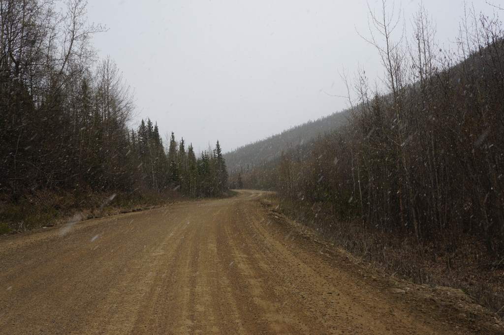
Leaving the campground near Chicken, the road was gently climbing and the snow was coming down. Road conditions worsened until there were huge chunks of crushed rock between the size of an apricot and a clementine. This was a very difficult section to ride! We only had to walk a little bit though, and eventually the dirt was back. We have never been so happy to see a dirt road! It didn’t help that it snowed on us most of the morning as we climbed into the hills. We did, however, resist the urge to flag down a truck for a ride. We were tempted…
Yikes! SNOW!
Up, up, up, and cold.
Terrible gravel chunks on the US side. We had to walk a bit!
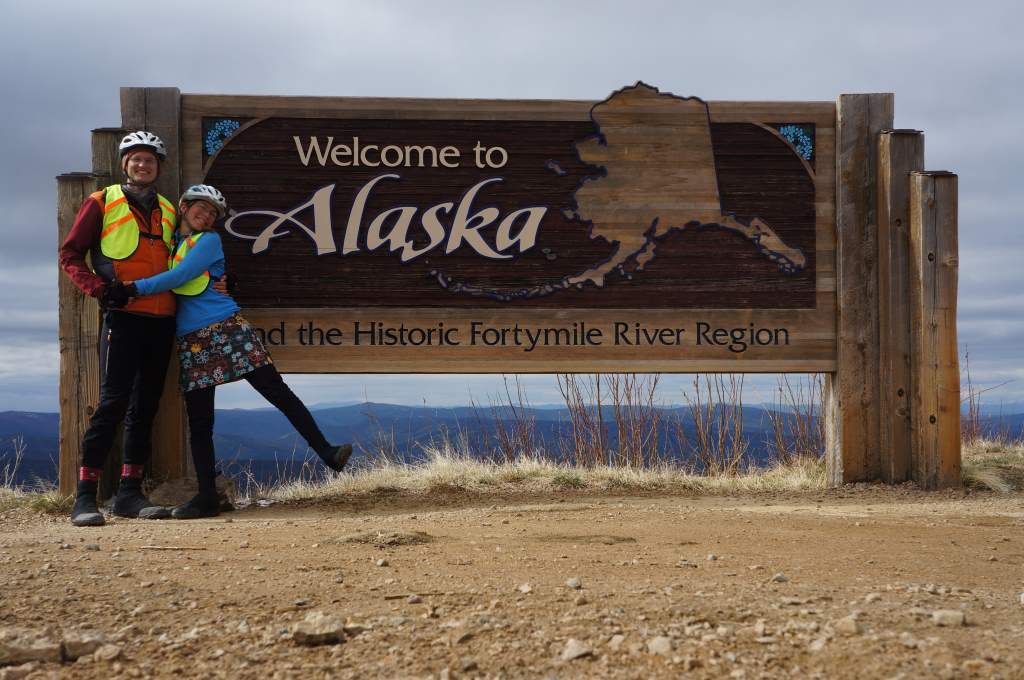
Goodbye for now Alaska – it has been memory-making.
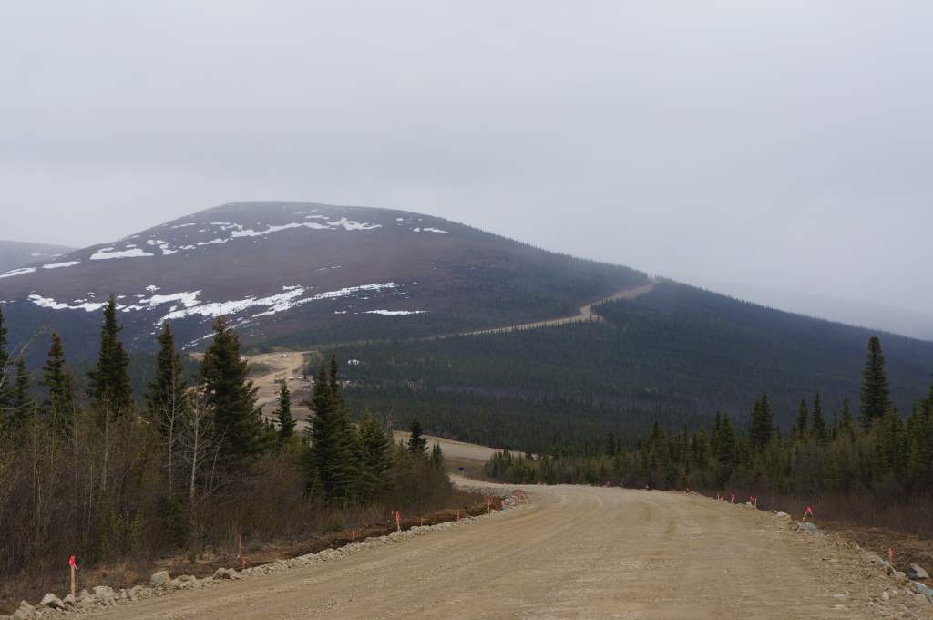
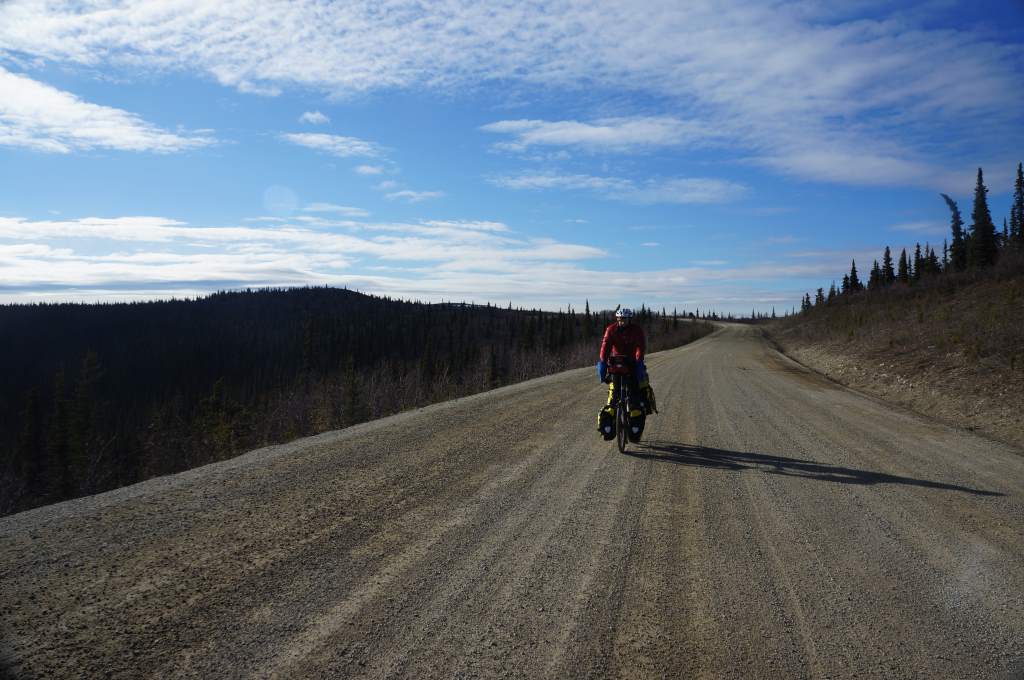
As we got closer to the border, we started to climb, climb, climb, and the clouds started to clear. I think it reached about 40 degrees, which actually felt hot with all the clothes we were wearing. The views were expansive, and we climbed up the side of a mountain and could finally see the border crossing – a little cluster of buildings perched high up. We were so excited when we finally reached them, that we wanted to whoop and yell, but the border guard was so very serious that he kind of killed the mood. No matter, we were soon past him and into the Yukon.
We wild camped next to the road, and spent a very cold night warm and snug in our tent. In the morning we could see that it had snowed, and accumulated a bit on the tent. We opted for a quick breakfast of peanut butter and jelly tortillas before heading out. It was to be a tough, tough day for us, although we didn’t know it yet. The Top of the World Highway mostly sticks to ridges as it winds across the Yukon, but often dips far into a valley before climbing steeply up onto the following ridge. Some of those climbs felt eternal to us!
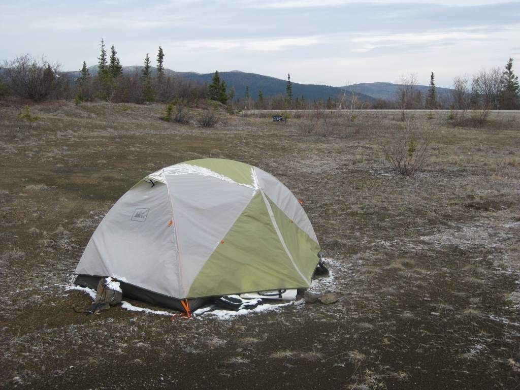
A dusting of snow and frozen water bottles in our wild camp.
The sun finally came out on our last day on Top of the World.
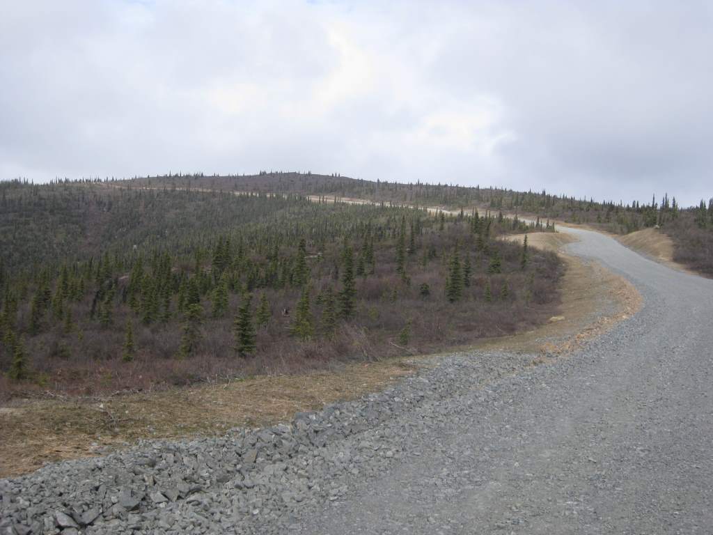
The weather was cold, but we could still see far in all directions and the mountains and river valleys were lovely. The road was sometimes pavement, but far more often it was gravel. We had a resolve-testing moment on an incredibly steep slope that had just had fresh dirt and gravel dumped onto it. I dubbed the machine doing that work ‘The Dream-Smasher’, and yes, we did have to push the bikes up a bit. It was so so steep!
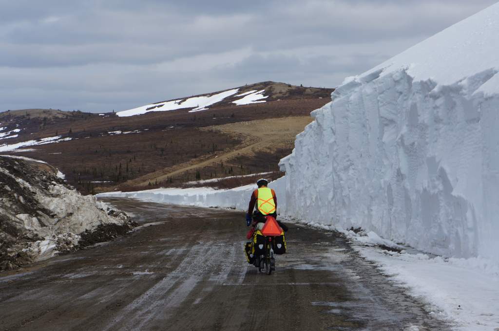
Recently opened road next to big snow wall.
We realized in the afternoon that we did not have sufficient water for dinner, and started to worry a bit. We scooped up some snow to melt, and flagged down a car to ask if they had any extra water. The guy looked at us and said ‘You know, it would be faster to just commit suicide.’ Ummm… whatever? He had no water for us, but the next truck did. Phew!
After dinner we were very very excited because the road became more civilized, with guardrails and gentle slopes. Then…. the wonder of the downhill sign appeared. 14 km of downhill! It was incredible, particularly when it switched to pavement midway. We found the Yukon River campground just across the way from Dawson City. It is a lovely campground, where spent 3 nights as we took two rest days in Dawson. I am so excited to be here! Next Stop: Whitehorse.
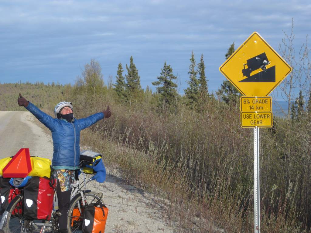
The blessed ‘downhill ahead sign’. It was a wonderful descent.
Adelante. La traducción no es muy buena pero se entiende. Hecho de menos un mapa para saber donde andais… besos desde Gran Canaria
Javier – econtraras un mapa en la pagina ‘The Route’, o ‘La Ruta’ (no se como seria traducida). Nos esta encantando esta aventura.
So impressive! Glad you took a few days rest! The word that continually comes to mind is “wow!”
Millie
Really cool! Look out for bears!
We try not to sleep with hot dogs in our pockets, and we don’t usually rub bacon grease on the tent…
Jason & Daisy,
We have been following your tip with delight from the beginning. I don’t think the guy suggesting suicide gets it.
I have been reading a travelogue by Phil Caputo called “Overland in Search of America, from Key West to the Arctic Ocean”. In a long digression on where to find the best cinnamon buns, he mentions the Chicken Creek Cafe, where he gave them a score of 8 out of 10. I never heard of “Chicken” before you’re posting; now twice in a day. Caputo also mentions the Testa River Campground, milepost 375.5 on the Alaska Hwy., B.C. where the sign claims: WELCOME TO THE CINNAMON BUN CENTER OF THE GALACTIC CLUSTER. He scores it off the charts. You might keep an eye out for that place.
Happy trails,
Bill
Haha – We’ll definitely stop in if we pass by! … Got our first Cinnamon bun from Braeburn Lodge a few days ago, and looking forward to more.