Author Archives: Daisy

Hiking the Inca Trail to Machu Picchu

May24MP_009

May21MP_008
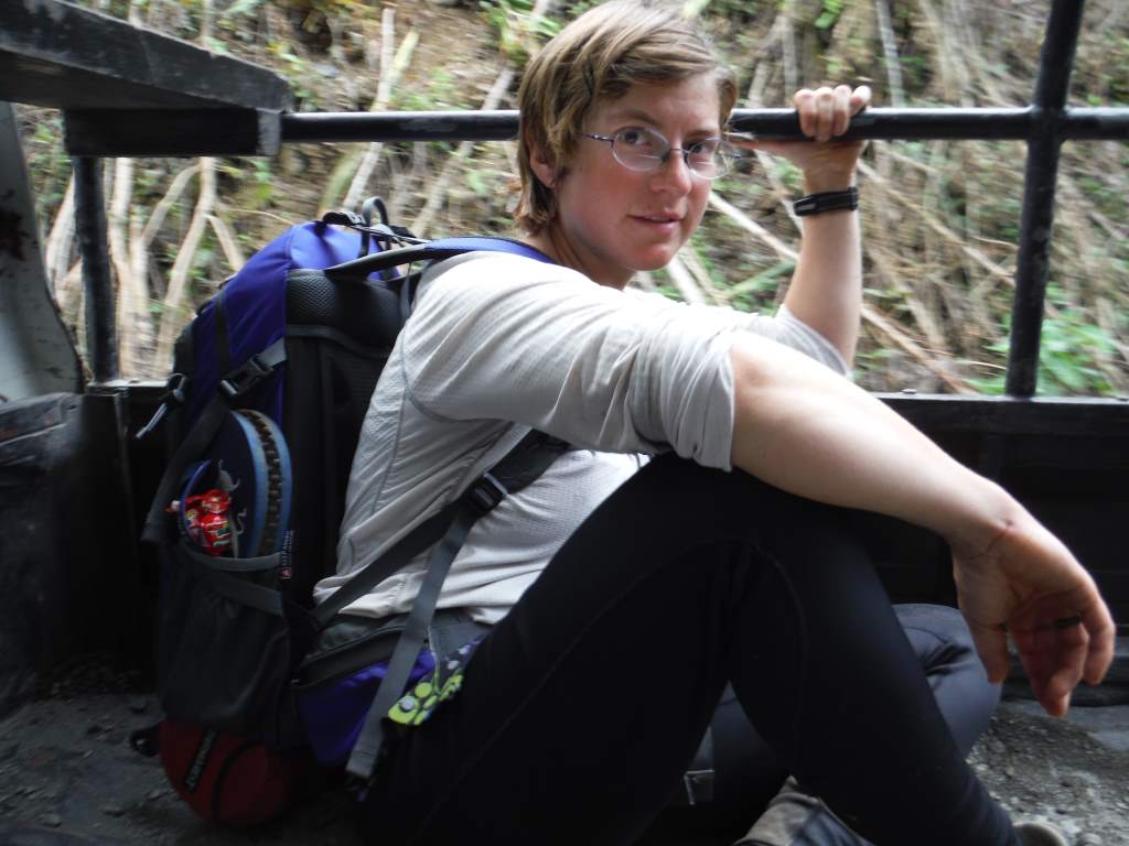
I know that in La Paz we decided that biking is far superior to hiking, but we decided to give it a second chance here in Peru. Of course, we had also booked our hike to Machu Picchu way back in January, so it’s not like we had too much of a choice! In the end, we had a great time. The weather was good, our guide was personable, the scenery was outstanding, and the food was excellent. For most of the 4-day hike we were in various stages of recovery and relapse from previous stomach ailments, so it was more challenging than it should have been for us. Besides the stomach problems the hike was a breeze. We did less than 10 miles a day, and the porters carried the heavy stuff. More on the porters later, since there is still our ride into Cuzco to describe.

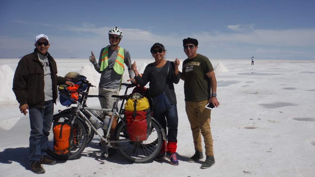
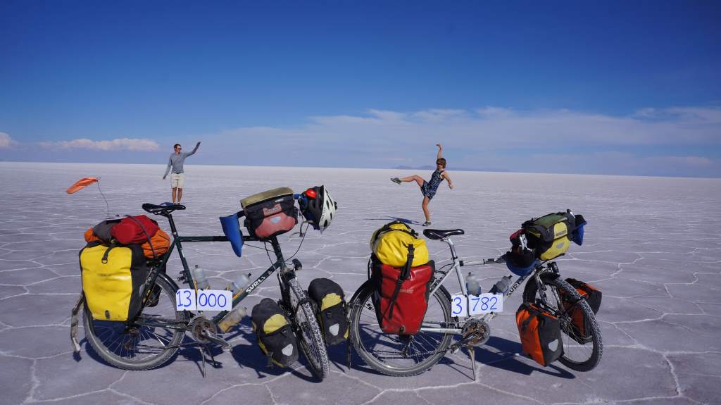
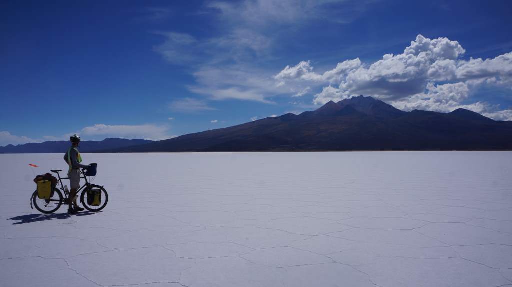
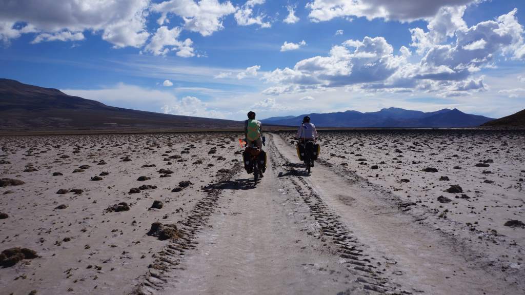
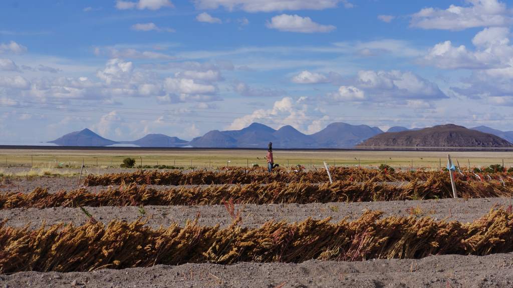
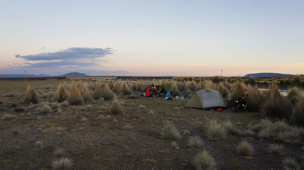
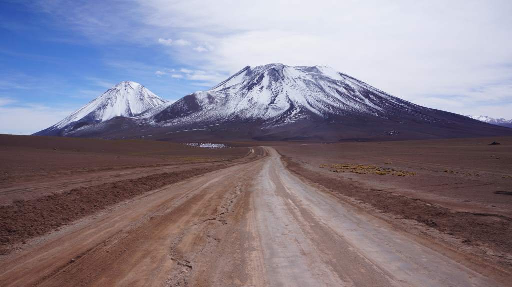
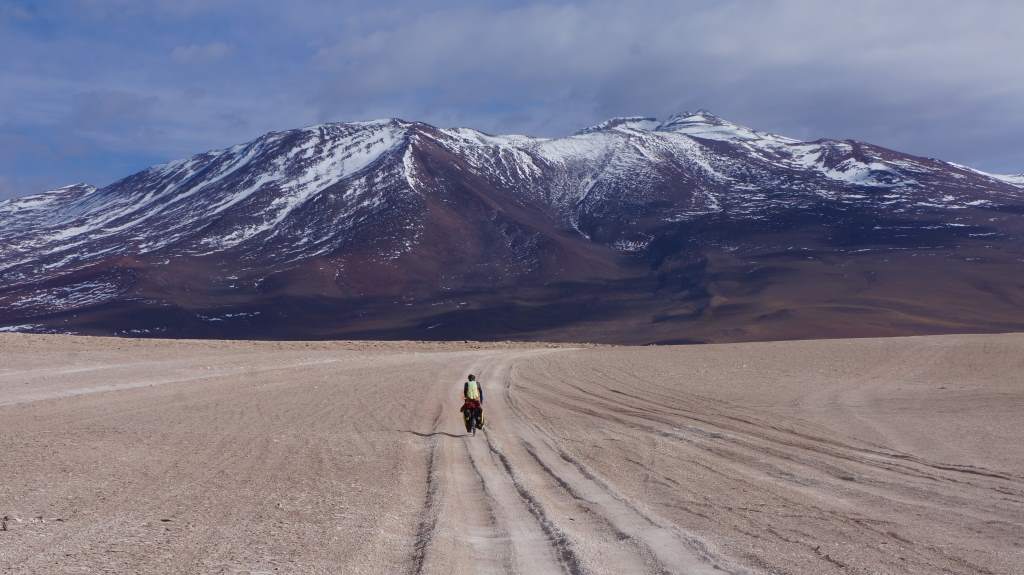
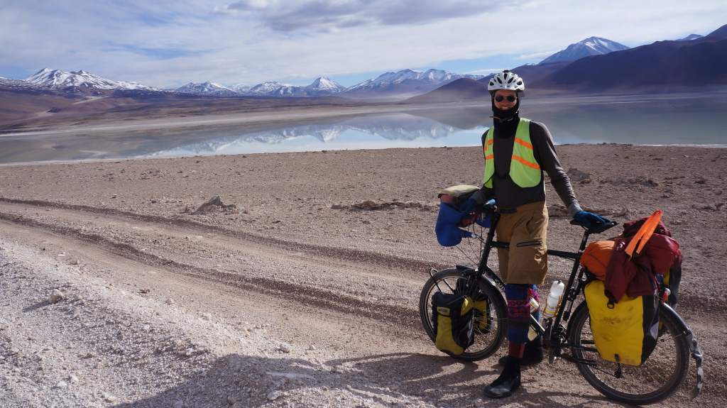
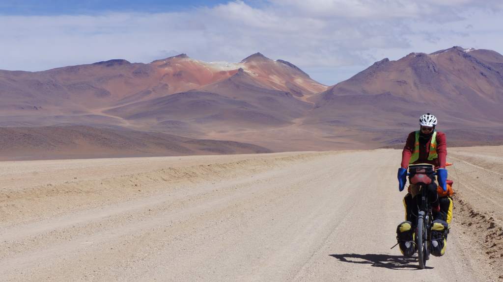
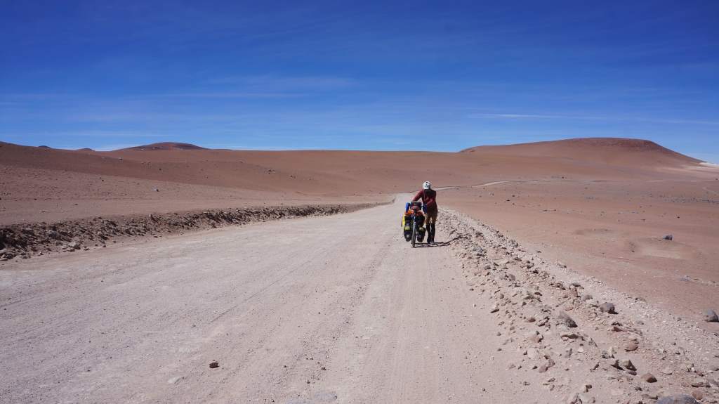
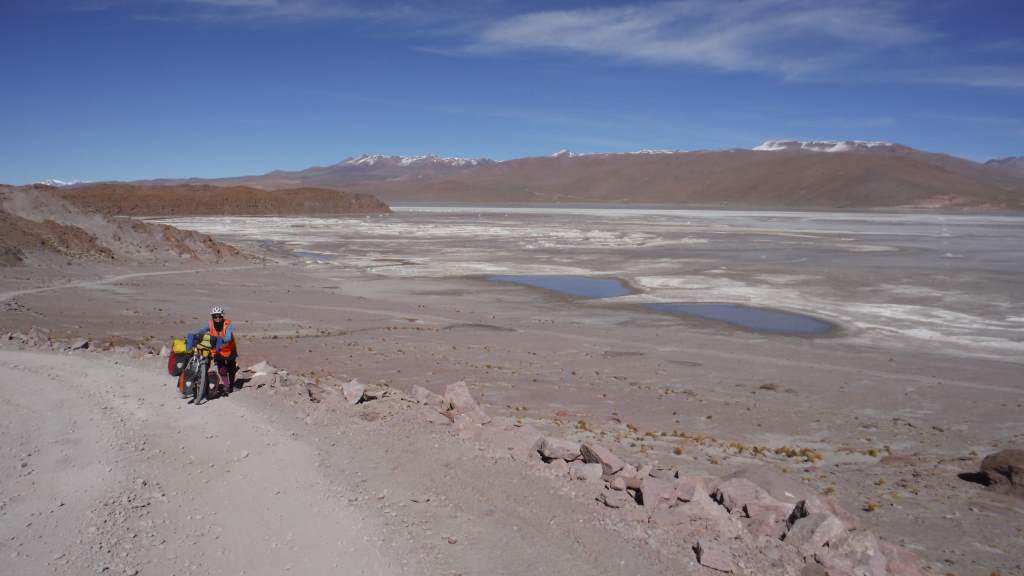
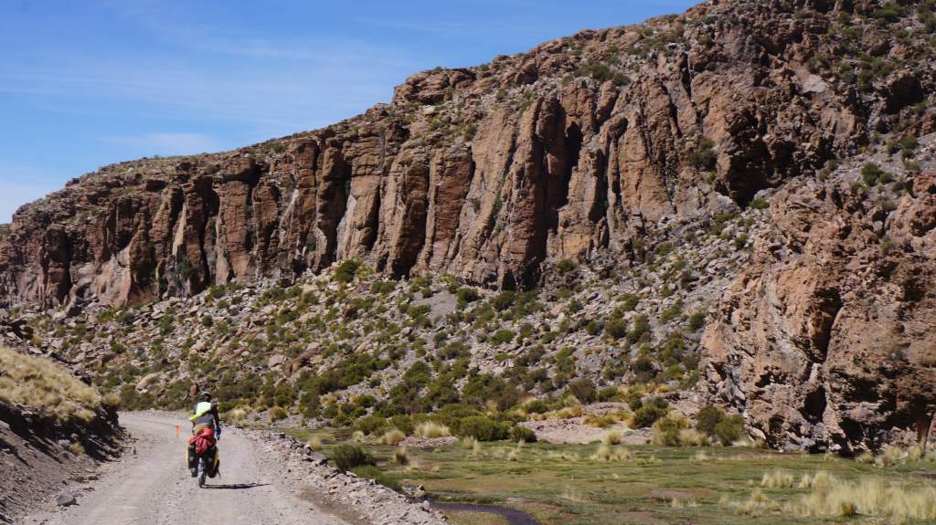
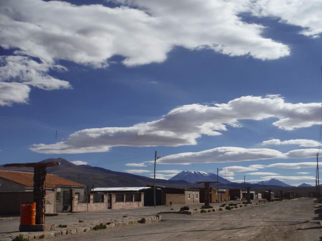
Last time we updated we were spending a day in the city of Sicuani, about 100 miles from Cuzco. We were stuck there for a day because I (Daisy) ate a pomegranate that gave me food poisoning. I spent an entire day alternating between the bed and the bathroom, and Jason was absolutely wonderful about taking care of me. He only left my side to venture out for food. The next day I was recovered enough to ride, but just barely. We made sloooow progress towards Cuzco, and managed to make it about 45 miles down the road to a cute town with a simple hostel. The next day we again made slow progress, but it was fast enough and we entered the city of Cusco exactly on schedule. Minor miracle!

May19_001

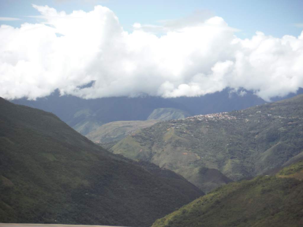
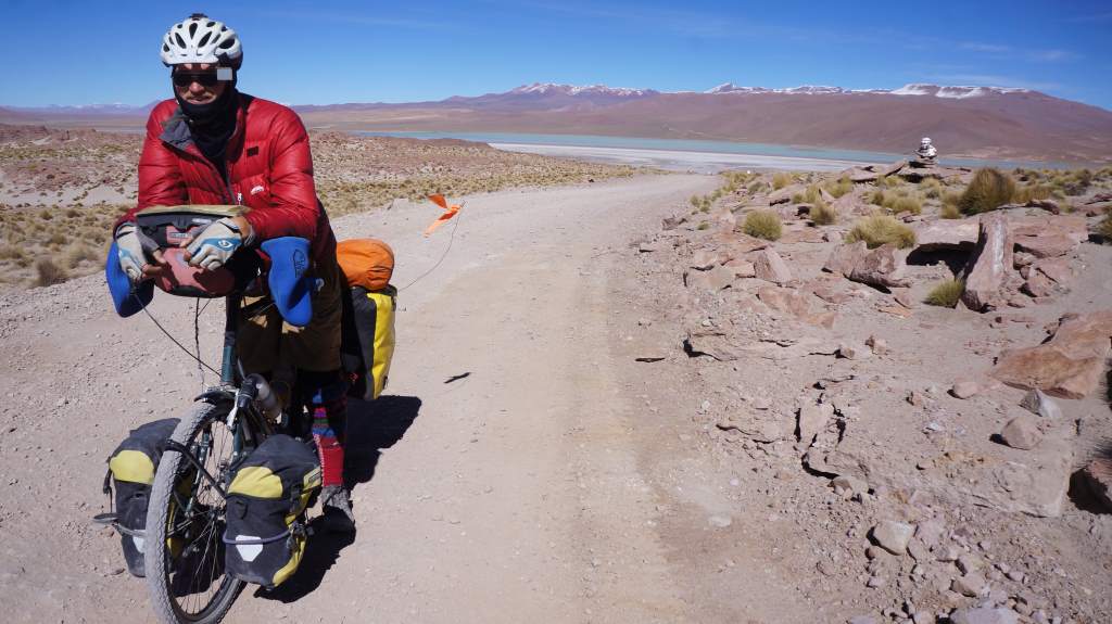
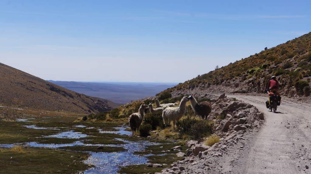
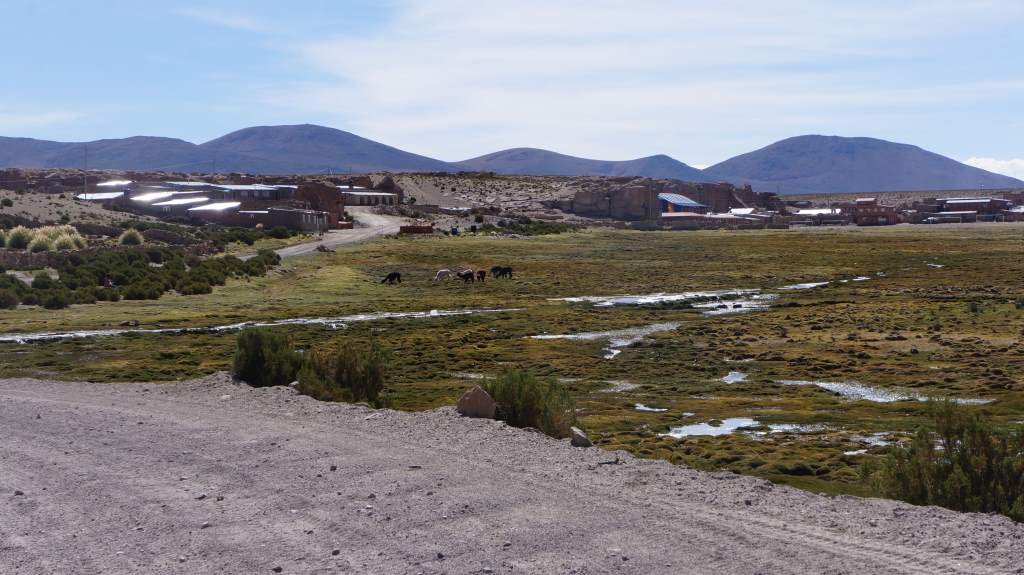
As we approached Cusco we started to see ruin sites everywhere!

May19_006

We had a bike lane for most of the ride into the big city.

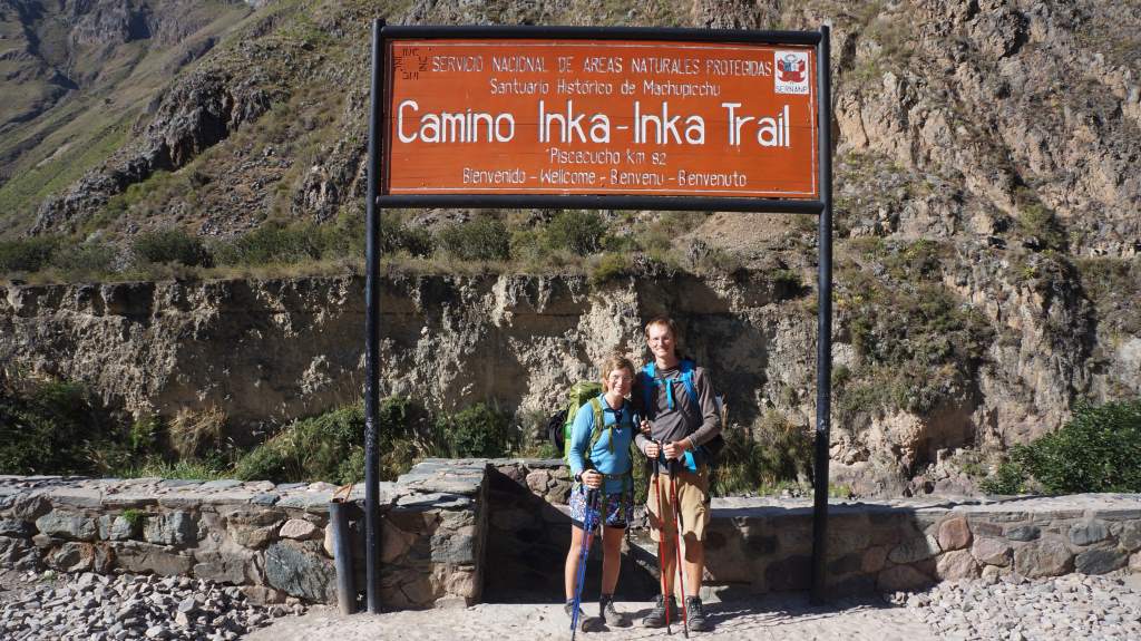
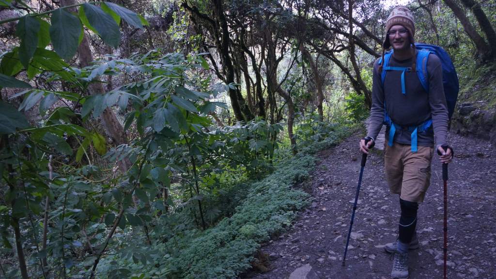
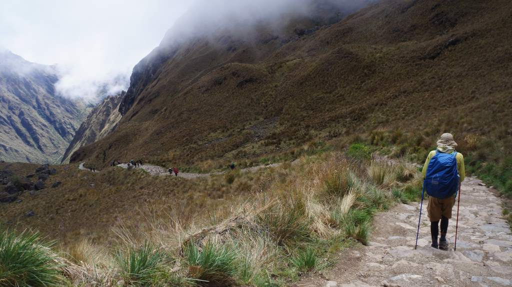
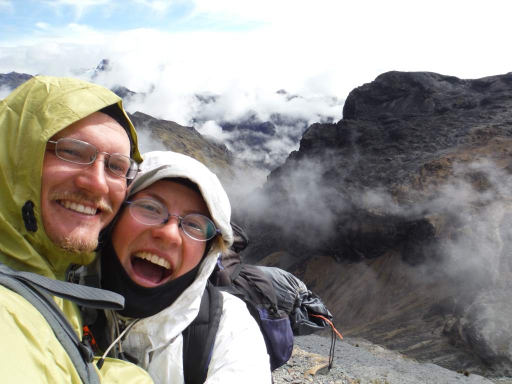
The next day we met our guide, Ronald, for our hike briefing session. Ronald is about our age, and worked first as a porter when he was a teenager, then as a cook, and finally as a guide. Our hike started the next day at the incredibly early hour of 5 am when the minibus came for us at our hotel. It was about a 2 hour drive to the trailhead, where we loaded up our packs and started walking.

May21MP_002

May21MP_005
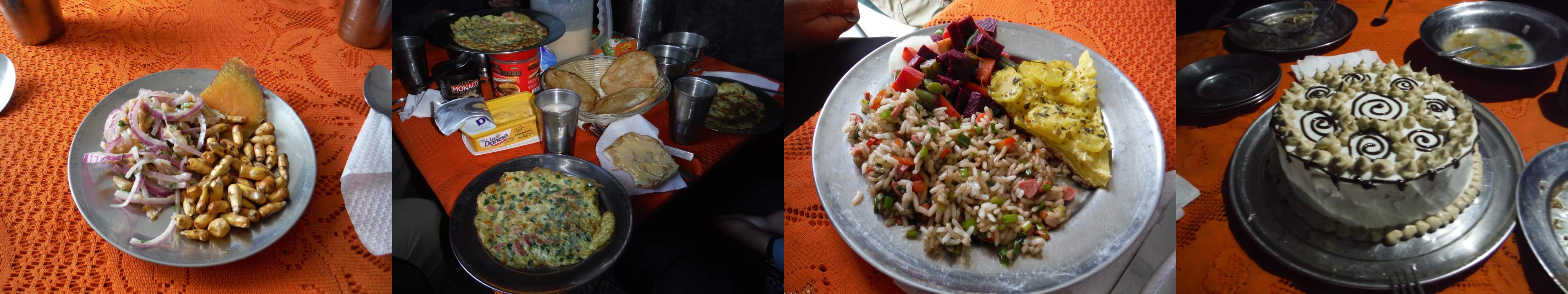
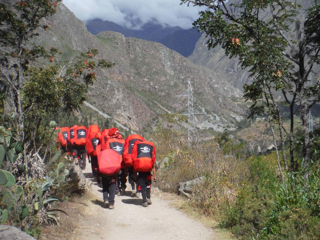
It was nuts. For each tourist that hikes this trail, there are about 2 people hiking it to support them. For our small group of 3 tourists, for example, there were 4 porters, a cook, and a guide. The porters carry these giant sacks (25 kg, 55 pounds) with simple shoulder straps, and many of them wear sandals as they run up and down the trail. They are supermen. Why do they need to carry so much? Because this hike turned out to be a luxury hike. We ate every meal in a meal tent, and they cooked elaborate meals fresh every day for all three meals. For breakfasts there were pancakes, or omelettes, for lunch and dinner we had soup followed by a plate with four different preparations. On our last night, there was even a fresh baked cake!

joined

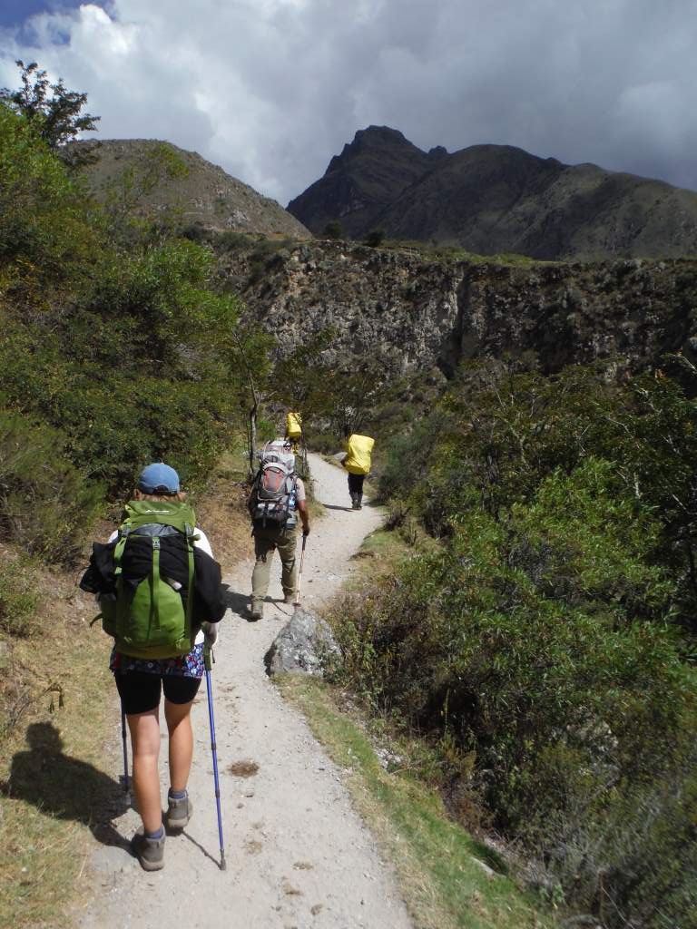
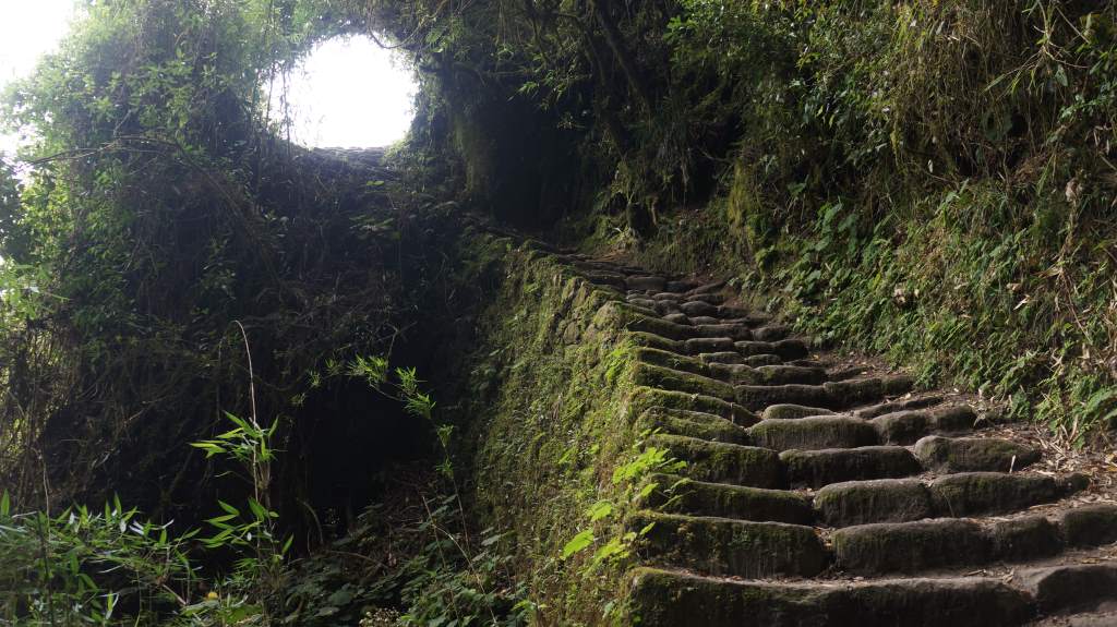
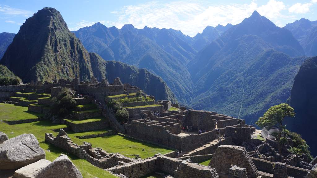
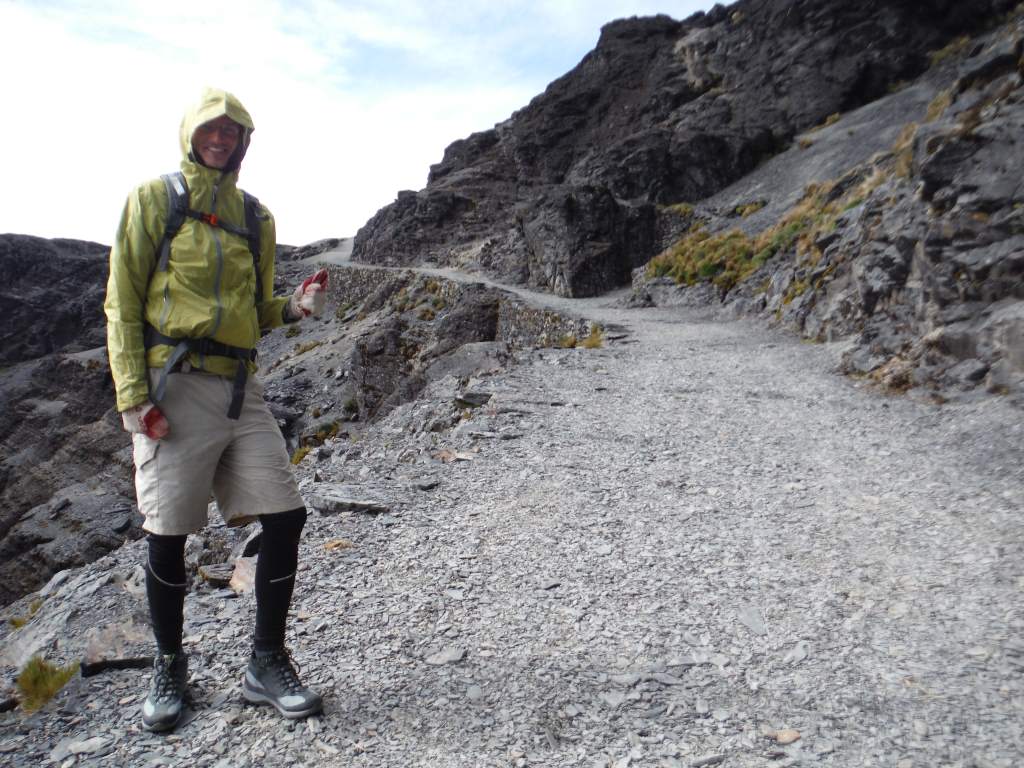
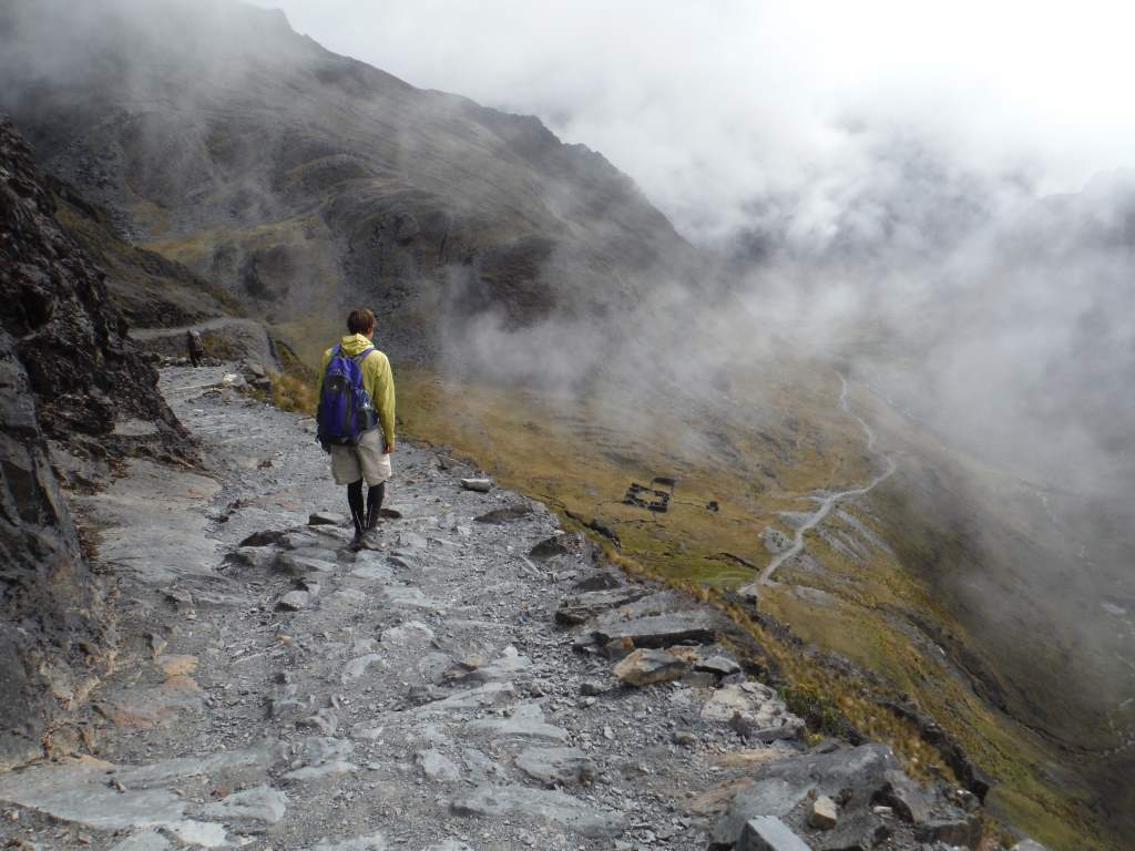
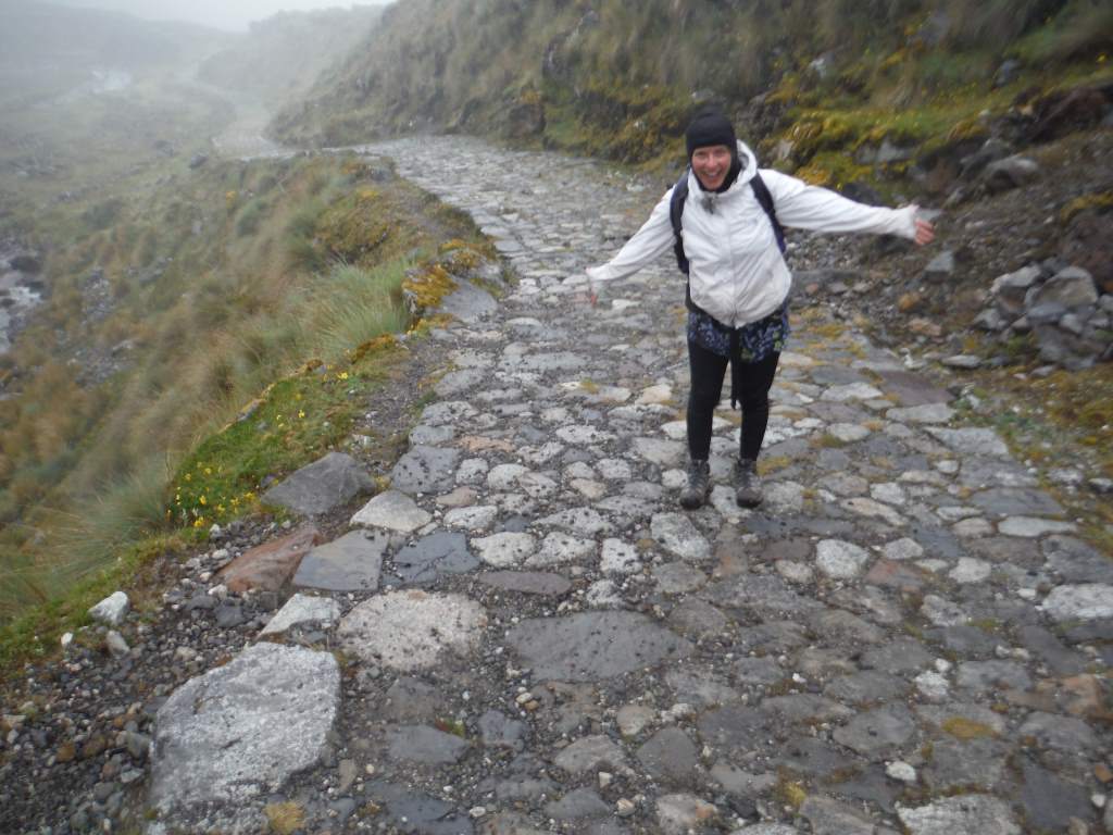
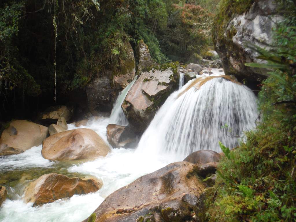
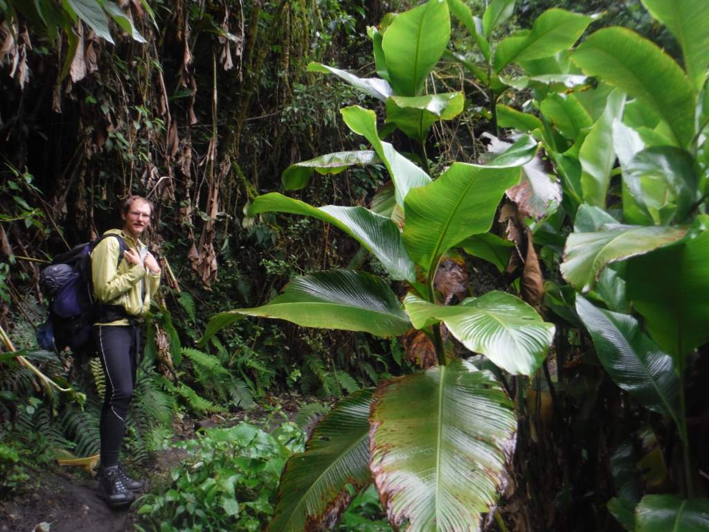
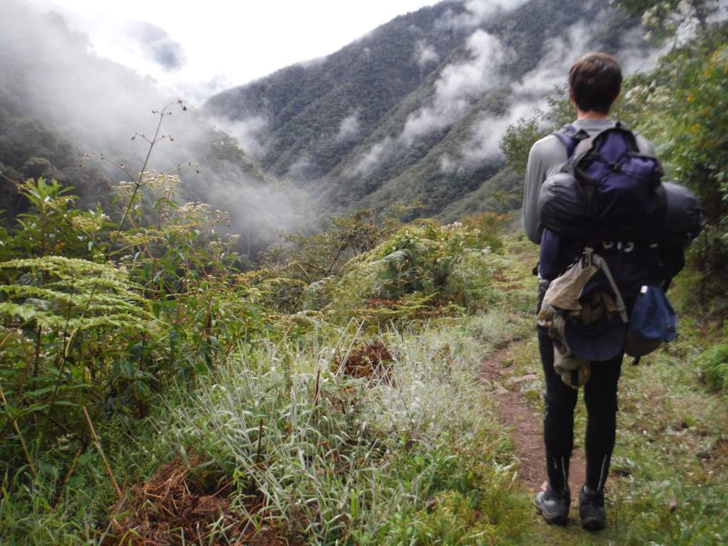
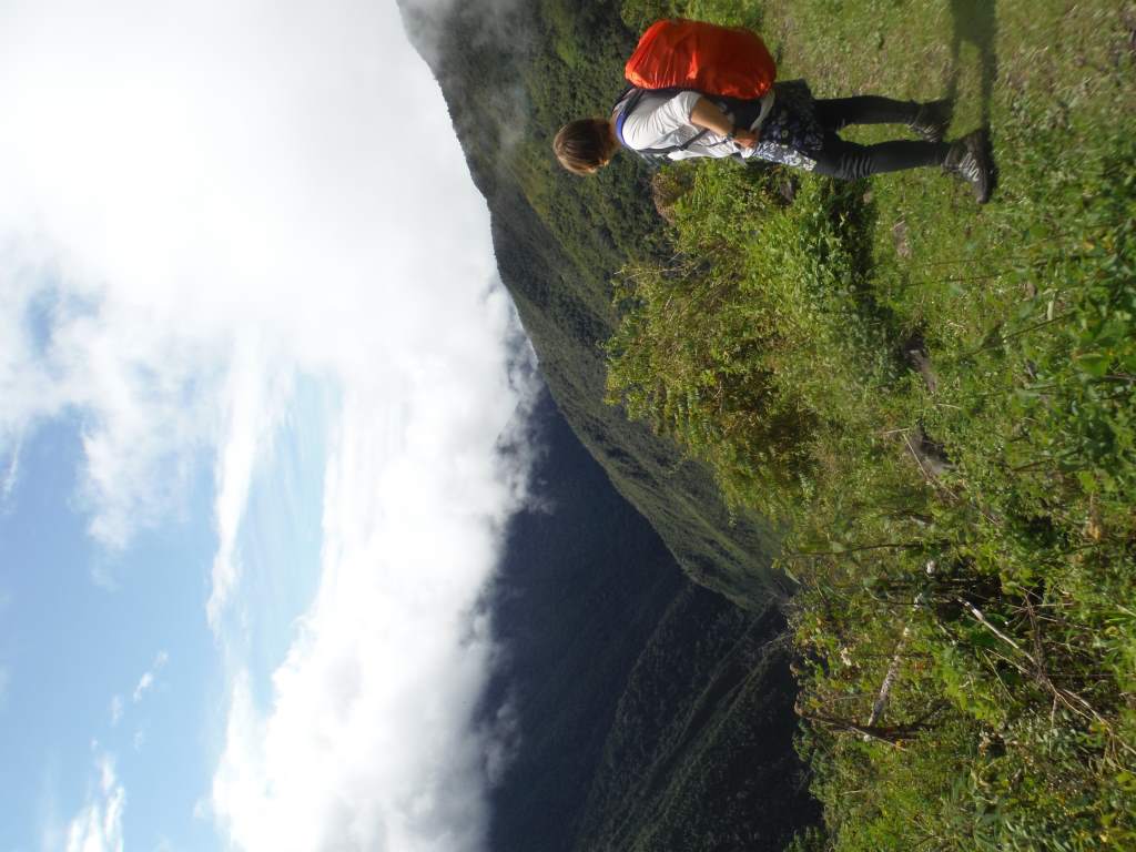
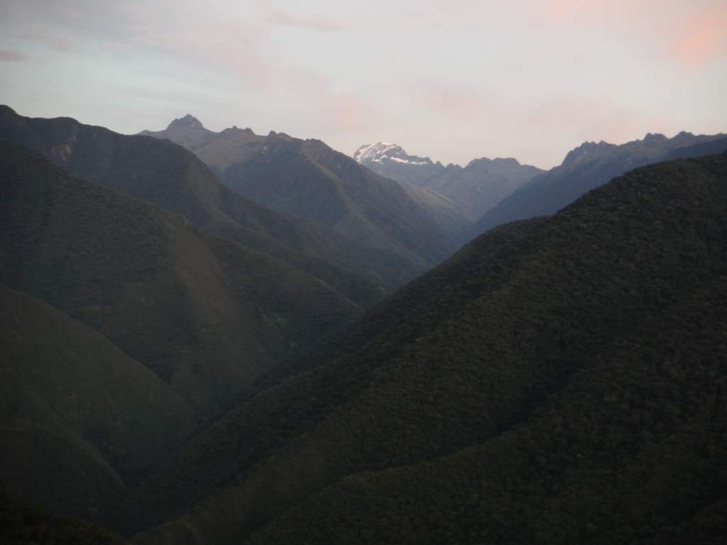
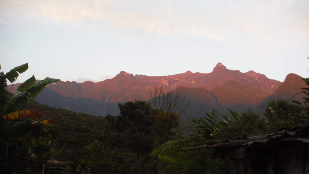
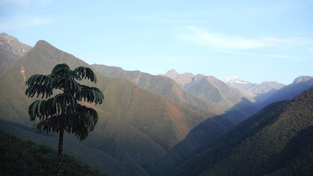
Enough about the food though. You probably want to know all about the beautiful mountains, lush valleys, and the Inca paved trail. Well, they were all just as wonderful as we had hoped. The mountains were so steep and impressive that it was like being inside a postcard. The valleys were full of rushing rivers and tiny hamlets. On the Amazon side, the forest was lush and we were serenaded by birdcalls. Finally, the trail was unbelievable. The Inca trail is carved out of steep hillsides and high mountain passes. For much of the trail we were walking up or down steep stone steps, and a couple times we had to go through tunnels created on the hillside. Walking this trail was like walking through a little bit of history.

May23MP_015 May23MP_022

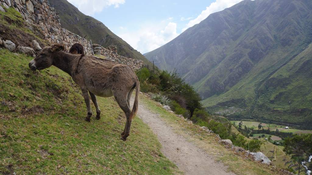
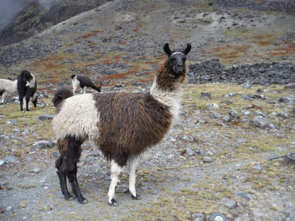
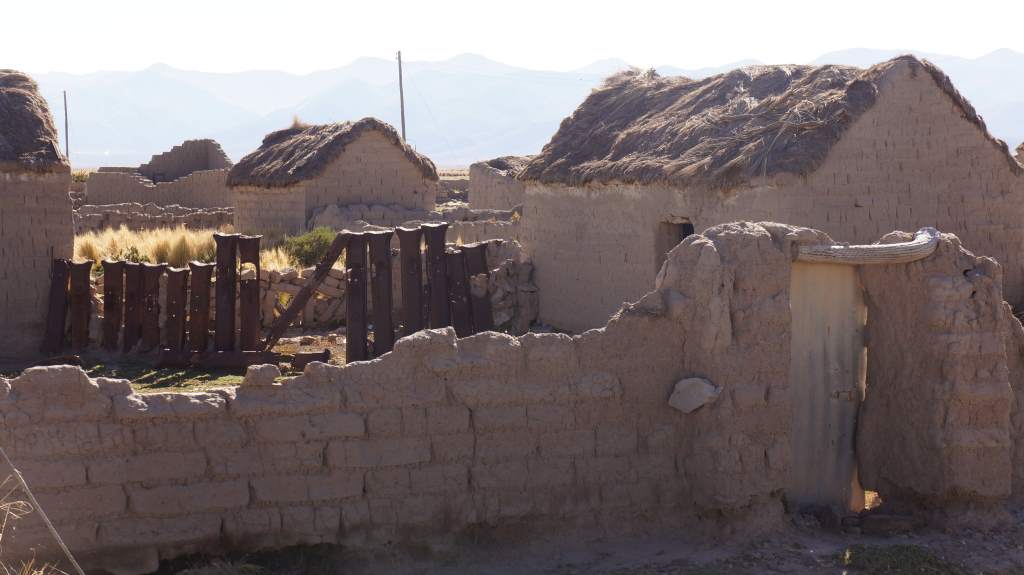
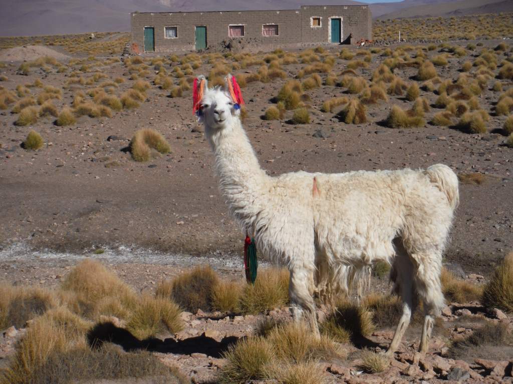
On our first day we were mostly in a valley where people still live, so we saw Peruvians going about their daily life with livestock and crops. We also saw the first of many Inca ruins.

May21MP_012 May21MP_013

May22MP_003
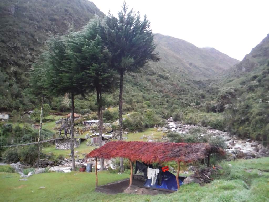
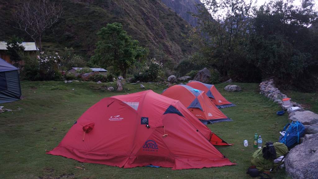
That night we camped in a farmer’s terrace, and spent time in the evening playing cards with our fellow hiker and our guide. Our group was small, just three, so we were lucky to be matched with Thiago, a friendly Brazilian. We had a nice time chatting with him during the day and in the evenings. When we had stomach problems he gave us some medicine, and when he got sore legs from the climb we gave him some ibuprofen, so we really were a team!

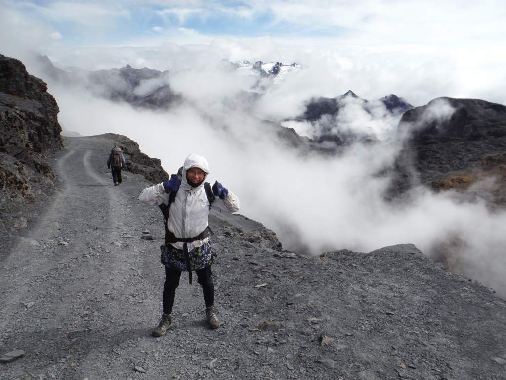
That night we fell asleep early, which is unsurprising considering the early start. The next day we got to sleep in until 5:30 AM! Ha. The porters woke us up by pounding on the tent and pouring us cups of coca tea. We spent all morning climbing up and up to a high pass with spectacular views. Many of the other tourists we saw on the trail seemed to be suffering from the climb and the altitude, but we had a nice time. The descent on the other side was tough! It was essentially a very long and very uneven staircase. We made it though!

May22MP_006 May22MP_012 May22MP_015

May23MP_003
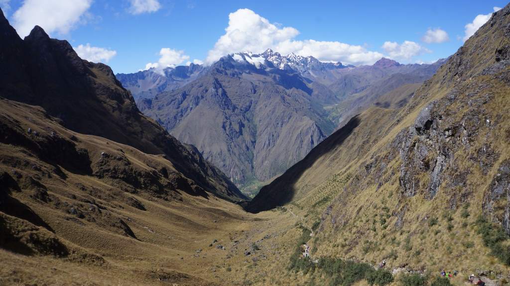
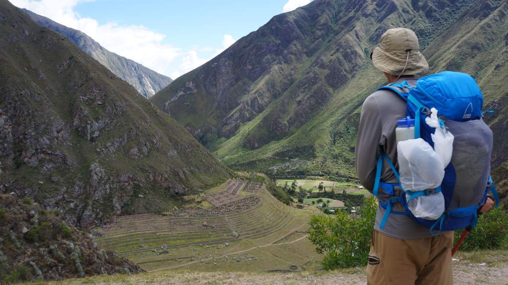
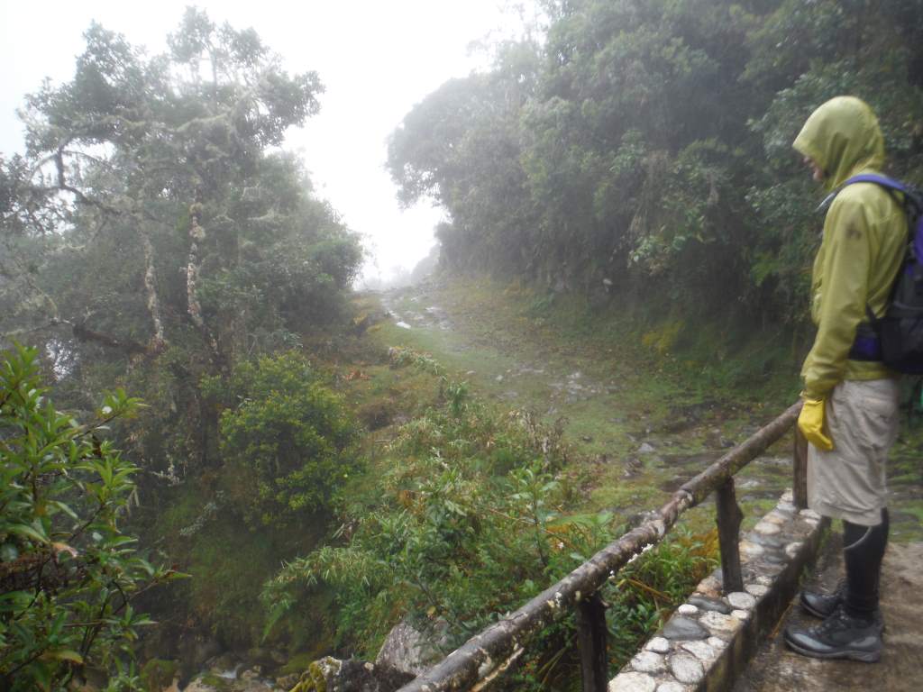
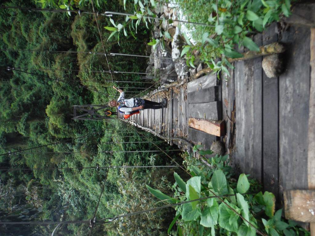
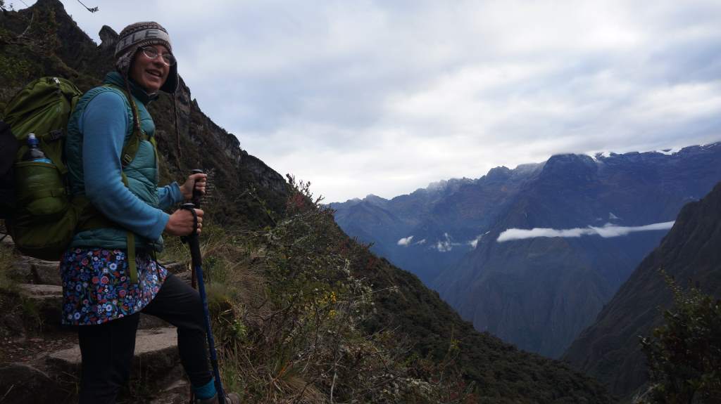
Our third day was our longest, and most eventful. We got up early again, and were climbing another pass for the first two hours of hiking. After that we got to poke around a lovely Inca ruin before walking through a cloud forest to yet another pass. In the afternoon it was all steeply downhill, and sometimes it was very, very steep. We reached another Incan ruin composed of agricultural terraces stretching up and down a huge hillside. It was stunning, and we learned that the Incas used some of their agricultural terraces as huge agricultural labratories. They domesticated and modified crops, as well as learning about what conditions produced ideal crop growth. The terraces, with their regular altitude shifts, made this possible.

May23MP_007

May23MP_019 May23MP_020 May23MP_009 May23MP_023

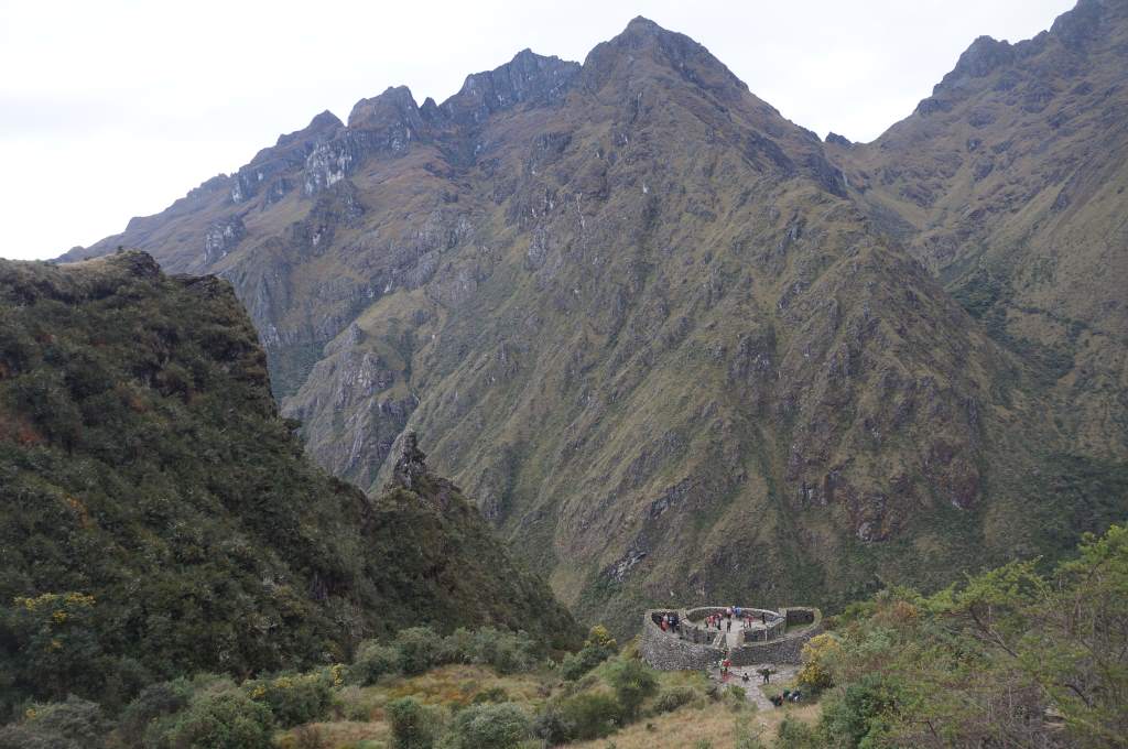
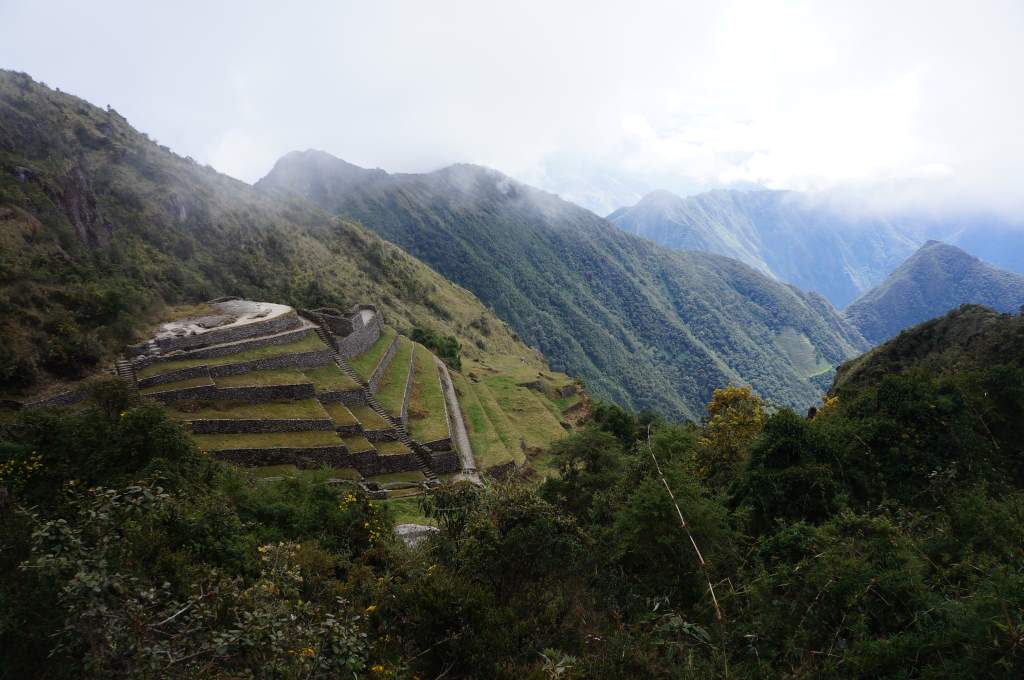
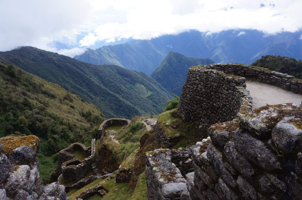
Near our final camp was yet another ruin, and this one was our favorite so far. It was another agricultural workshop, but it also included 20 stacked baths where the pilgrims to Machu Picchu would wash themselves. The best part was wandering through the ruins without another tourist in sight.

May23MP_028 May23MP_029 May23MP_030

May24MP_006
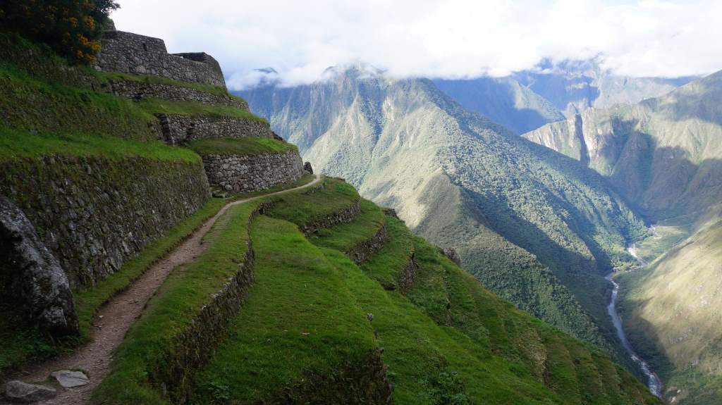
The final, much awaited day began at the ungodly hour of 3:30 am. The porters needed to catch the early train out of the valley, so we had to be out of our tents and moving super early. Of course, we didn’t move very far. About 5 minutes of hiking after leaving camp we had to sit and wait for 1.5 hours for the trail control to open. It was cold, but we managed. As the sky slowly brightened we hiked quickly towards the Sun Gate, the overlook from which we would get our first glimpse of Machu Picchu.

View from the Sun Gate.

View from the Sun Gate.

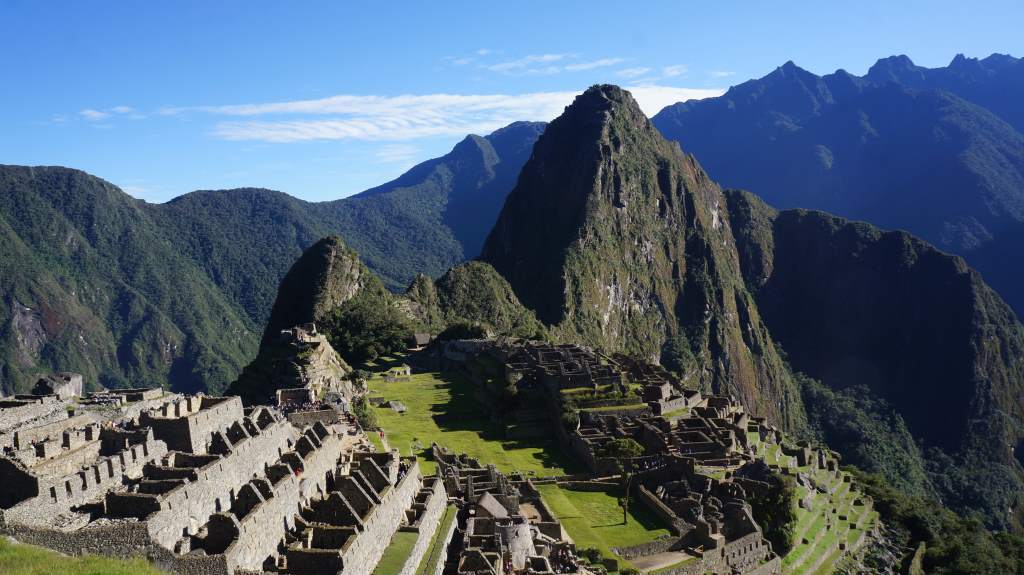
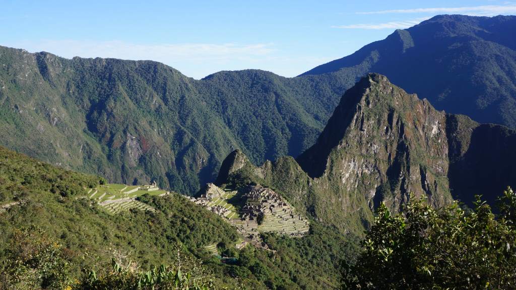
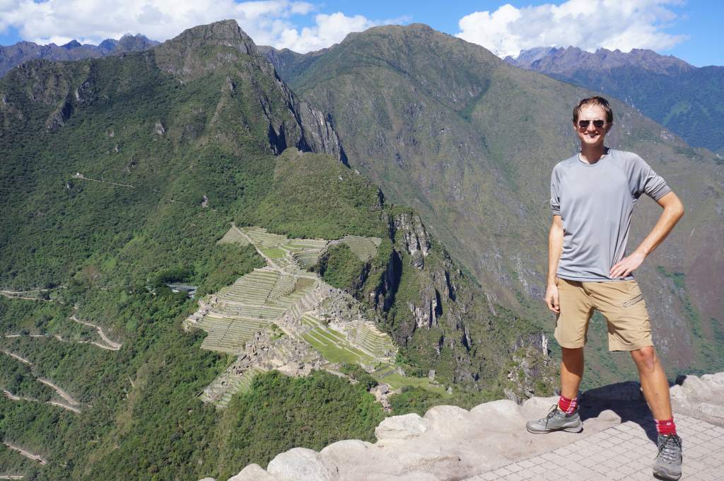
We were very lucky, and the conditions were perfect. The sky was clear, and we watched as the sun slowly climbed high enough to reach Machu Picchu. It was lovely. From there, it was all downhill to the lost city of the Inca.

May24MP_012May24MP_013
May24MP_017
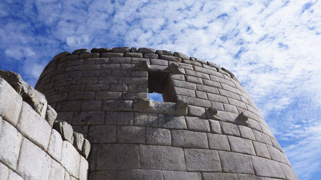
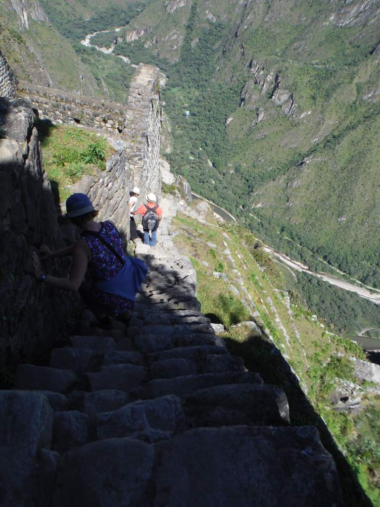
Our adventure wasn’t quite over though. We still had to climb Huana Picchu, the hill behind the city. There is an ancient fortress at the top, and a long series of perilous steps that wind up the mountain. When we signed up for this ‘bonus hike’ we didn’t actually know how terrifying it would be! The trail wound up the mountain, and near the top it became a set of narrow, insanely steep steps. AfterMay24MP_018 a few celebratory photos at the top it was time to start down again, but this was the scariest part. Imagine climbing down with that view, without anything to hold onto, and on narrow, uneven, steep steps. It is unbelievable that up to 400 people do this (and survive) every day. It was a great relief when we were back on more even ground.

May24MP_015

Even though we were done with Machu Picchu by 1 pm, we still had many hours before returning to Cuzco. The nearest town (accessed by a very curvy bus ride!) is called Aguas Calientes, and it is only accessible by train from the outside world. This made for a fun afternoon of wandering the car-free town and eating lots of cake and coffee. Our train left just after dark, and we were back in Cuzco close to midnight. A very long day!

Town accessed only by railroad.

Town accessed only by railroad.

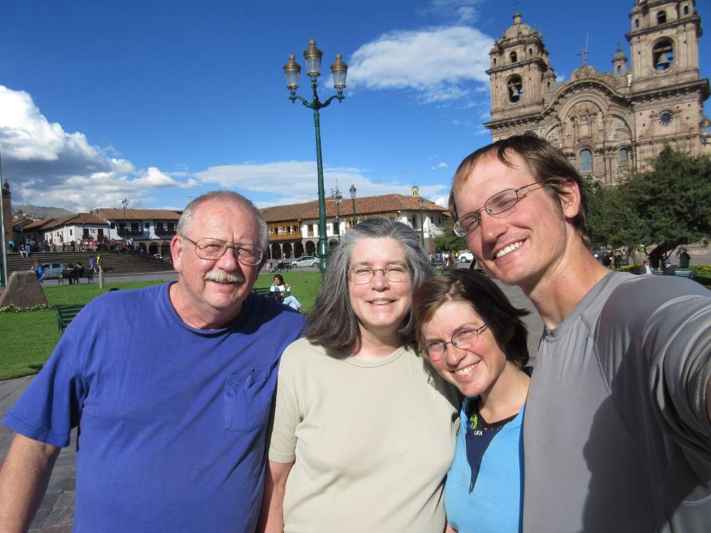
The best part of returning to Cuzco was our welcoming party: Jason’s parents! They made the long trip to Cuzco so they could spend a week with us, and we have had a truly lovely time with them. You’ll have to wait for our next update to read about it though!

May20_003

Three days hiking to remind us that bikes are better

Up at the top near La Cumbre, around 16,000' (nearly 5000 m)

Up at the top near La Cumbre, around 16,000′ (nearly 5000 m)

Our time in Bolivia (on bikes) has been restricted to the high and dry altiplano, but we wanted to get a glimpse of the tropical lowlands before leaving the country next week.  For this reason, we decided to do a three day hike that starts in the high mountains and winds down a river valley into the steamy jungle.  We also wanted to break in our new hiking shoes (bought in La Paz) before our 4-day hike to Machu Pichu which we will start in another couple of weeks.

Because we didn’t have backpacks, and we were nervous about undertaking the hike, we decided to hire a guide through a travel agency.  Our ‘guide’ turned out to be more of a porter and a cook.  This was all good and well, but we could certainly have carried our own gear and cooked our own food.  We were disappointed that he didn’t tell us anything about the areas we were hiking through, and even more so when it came time to return to La Paz.  It was a nightmare half day of finding public transportation (4 separate vehicles), and our guide seemed just as lost as we were.  In fact, Jason was the one who found us the main transport to La Paz!

Despite the shortcomings, we are glad we did the hike.  Our legs are more or less destroyed from descending so many miles on rough, slippery trails, but we got to see the lush jungle and even a wild monkey!  In the narrative below I’ll try to share a bit about our time on the trail.

Day 1:  
We were super excited to start the hike, and a little nervous too since it’s been over a year since our last real hike. We agonized over what items were actually worth carrying. We decided we only needed one sleeping bag, and that we didn’t need too much warm gear since we could use our sleeping bag liners as warm togas. We might have looked a bit funny, but it worked!

DSCF5399

DSCF5407

We were transported in a taxi to the highest part of the trail. When we got there it was high, beautiful, and cold! We got wrapped up in our sleeping bag liner togas, and started down the trail.  The views were good when the clouds parted enough to let us see. Our guide took off in front of us, and we made our own careful way down the steep and rocky path. This first bit of hiking before lunch ended up being one of our favorite parts of the whole thing. There were very few plants, but there were steep rock faces, cute llamas, and stone ruins. We watched the clouds rise from the depths of the valleys until we were in them, and for the rest of the day all we saw were clouds.

It was a long way down...

It was a long way down…

DSCF5422

Just as we stopped for lunch the rain began, and it continued for the rest of the day. The path was actually very nice, and we mostly stayed happy, but not completely.  They didn’t give us a rain cover for the rented backpack, and we had to do quite a bit of shuffling to get our gear in places where it would stay mostly dry.

Stone-paved trail, in the Inca style

Stone-paved trail, in the Inca style

DSCF5458

Everything got a lot greener!

Everything got a lot greener!

For the rest of the day we picked our way downhill steeply on slick stones, with our guide somewhere off ahead of us. It was with great relief (and the beginning of tired legs) that we arrived at our intended destination with a covered camping area.

It got wet.

It got wet.

Jason was very excited to see the bridge to a covered camping spot!

Jason was very excited to see the bridge to a covered camping spot!

That night was pretty fun. We had snacks and a little chat with our guide, Tomas. He has four mostly grown kids, one of which is in college. It was nice to chat with him, and this was our only chat for the rest of the trip, which was passing strange. He cooked us a yummy dinner of soup, pasta, meat, and some simple veggies. We chatted some more with a lovely Belgian couple also doing the hike, then headed to early bed.

Day 2.
Luckily, the day dawned a bit drier, and it wasn’t too cold.  Tomas insisted that we get up at 5:30 am, so the alarm went off in complete darkness.  We were hiking by first light.  The trail began to be overgrown with jungle-type plants, and there were many crossings of raging streams. The first three hours were super slippery, but after that the trail improved and we could walk more or less normally. Of course, by this time our legs were already sore from the previous day.

It was clear and not raining early in the morning.

It was clear and not raining early in the morning.

DSCF5514

DSCF5520

The entire day was long and tiring, but through lovely scenery with some great views when the clouds parted. At times the hot air rose from the valleys and made us feel like we were in a sauna. At other times a cold wind came down from the hills and cooled us off. The trail went up and down, following the side of the mountain and dipping down to cross many streams.  We finally emerged to our destination of Sandillani. It used to be a happening place, with manicured japanese gardens, an eco-hostel, and snack bars. Currently, however, it is abandoned and strewn with trash.  We set up the tent, hobbled around a bit, and were mostly incredibly sore from 8.5 hours of hiking.

DSCF5522

DSCF5547

DSCF5531

Jason's nasty wet foot, I'm sure you wanted to see that!

Jason’s nasty wet foot, I’m sure you wanted to see that!

Working out some soreness with a hot water bottle massage.

Working out some soreness with a hot water bottle massage.

The trash pile is under the roof of the only covered camping spot.

The trash pile is under the roof of the only covered camping spot.

Day 3.
That morning was lovely – our other favorite part of the trip. The day dawned clear and the sunrise over the mountains was beautiful. We enjoyed taking pictures from the overlook and having a slightly more mellow morning. Our guide suggested that we get on the road by 7 so that we could be in town by 10 in time for the direct bus back to La Paz.

DSCF5604

DSCF5614

DSCF5631

Our final descent to civilization was a mostly easy and pleasant 2.5 hour walk. We kept our pace up high so that we could get the bus, and we were super relieved when we emerged from the jungle. This was when things started to go wrong, however. Our guide seemed to have been confused about the timing to the bus, since this first town didn’t have one and it was an hour walk along the road to the next town. When we got there we learned that the only bus was at 2 pm. Our guide was supremely uncommunicative regarding how we would get back to La Paz, and he seemed mainly concerned about doing it in the cheapest way possible. We kept asking him what was going on, and he would respond evasively. He said we needed to get to the main road, but wouldn’t pay the 5 Bolivianos per person to get us there in a vehicle. We were exhausted at this point, but still unwilling to start paying for the transport that was included in the tour. We started walking, but luckily a truck was willing to give us a free ride.

Finally, we see a small town!

Finally, we see a small town!

At the main intersection we had to stand there and hope for a minibus to come by. After a long while, one did. It was a crowded and incredibly bumpy 30 minute ride in the wrong direction to get to the hilltop town of Coroico.

DSCF5660

Once there we needed to transfer to a minibus for La Paz. The guide didn’t seem to know where to find one, and was hesitant to look at the nicer seeming ones because of price. Jason found the minibus for us, and within moments we were flying back down the bumpy road towards La Paz.   Our guide didn’t give us the promised lunch, so we bought empanadas from some ladies at a quick stop through the bus window during the ride. We finally reached La Paz, but still had to transfer once more to another crazy minibus to get back downtown. It was with very great relief that we returned the backpack, gave our guide a reduced tip, and hobbled back to the casa de ciclistas.

Looking back at the hilltop town of Coroico as we fly up the highway to La Paz.

Looking back at the hilltop town of Coroico as we fly up the highway to La Paz.

We are now taking another day of rest in La Paz to let our legs recover before we brave the climb out of the city.  My legs feel like someone has been hitting them with a meat tenderizer!  Next we will ride the two days to Lake Titicaca, where we might take another hike.  From there we will enter yet another new country: Peru. We have heard fantastic things about Peru, and we are very excited to get there!

Cycling the world’s largest salt flat

Since our last update we spent two magical days on the Salar de Uyuni, which has the distinction of being the world’s largest salt flat. The salt flat is the remains of an ancient (and massive) lake, and it provided perfectly flat riding on a lovely surface. It also warps your sense of perspective and scale, allowing for some fun and hilarious photo opportunities. For the most part, this post is just a good excuse to share with you some of the pictures we took during our ride on the salt. Of course, we also spent a magical night on the salt, explored a desert island in the salty expanse, made our own path back to land, rode through a llama field and a mud flat, and had a couple of adventures in small Bolivian towns. First, the salt!

The Philtrons as tourist attraction.

The Philtrons as tourist attraction.

The first part of the salt flat was packed with tourists in jeep tours. They all run out of the jeep to take perspective photos, and then when they see us they freak out and swarm. We had to answer the same questions umpteen times, but a few were new. One woman from New Jersey asked us if it was flat all the way to Ecuador! The answer is a resounding NO, for the record!

Apr27_007

We rode away from the salt hotel and other tourist spots near the edge of the salar and headed towards the middle. About 40 miles from ‘land’ we stopped for our own photo shoot, since we had reached 13,000 miles! We are still riding with Emma and Debbie, the New Zealanders, so we were lucky to have someone else take our photo for once! Here are some of the photos:

Apr27_011 Apr27_010 Apr27_008 Apr27_009 Apr27_014

Did I mention we finally made it to 13,000 miles??!

Apr27_012

Apr27_024That night was camped on the salar in the vast expanse of nothing but hexagons formed by salt. We watched the sunset, which seemed to happen in slow motion, and then after dark we watched distant lightning storms in the mountains. It was a wonderful night.

Apr27_019

Apr27_021Apr28_005The next morning we reached the Island Incahuasi, which is another huge tourist draw. Lucky us, we had the whole place to ourselves since we are on a different schedule from the jeep tours. We hiked to the top of the island, saw many many cacti, and enjoyed the peace. From there we rode on the salt again, straight towards a towering volcano. It was a completely different experience to be off the jeep “road”, and to simply choose our own path. We decided to ride around the volcano on the salt, and then head for land on the far side. Sometimes the salt surface got soggy, and we had to race across it to keep from sinking! Even when we did reach land we had to cut through mud flats and across fields before finally finding a track to ride.  The track led us through fields of llama and quinoa before it led us to town.

Apr28_009

Apr28_014 Apr28_011 Apr28_017Apr28_019 Apr28_020Apr28_023
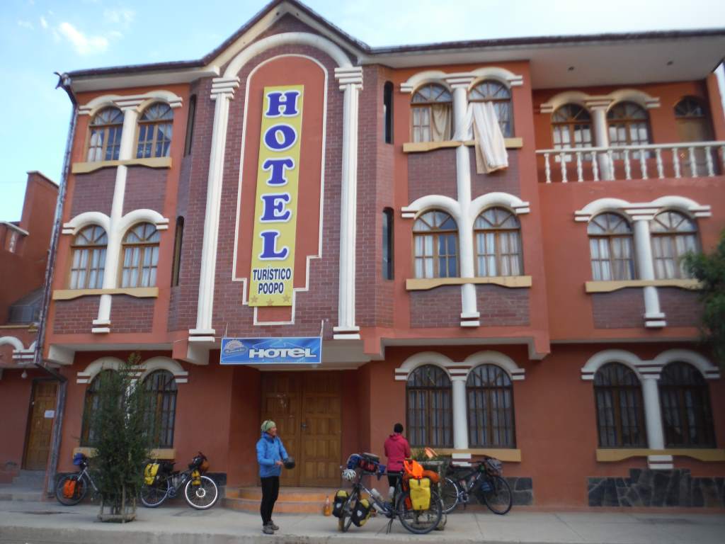
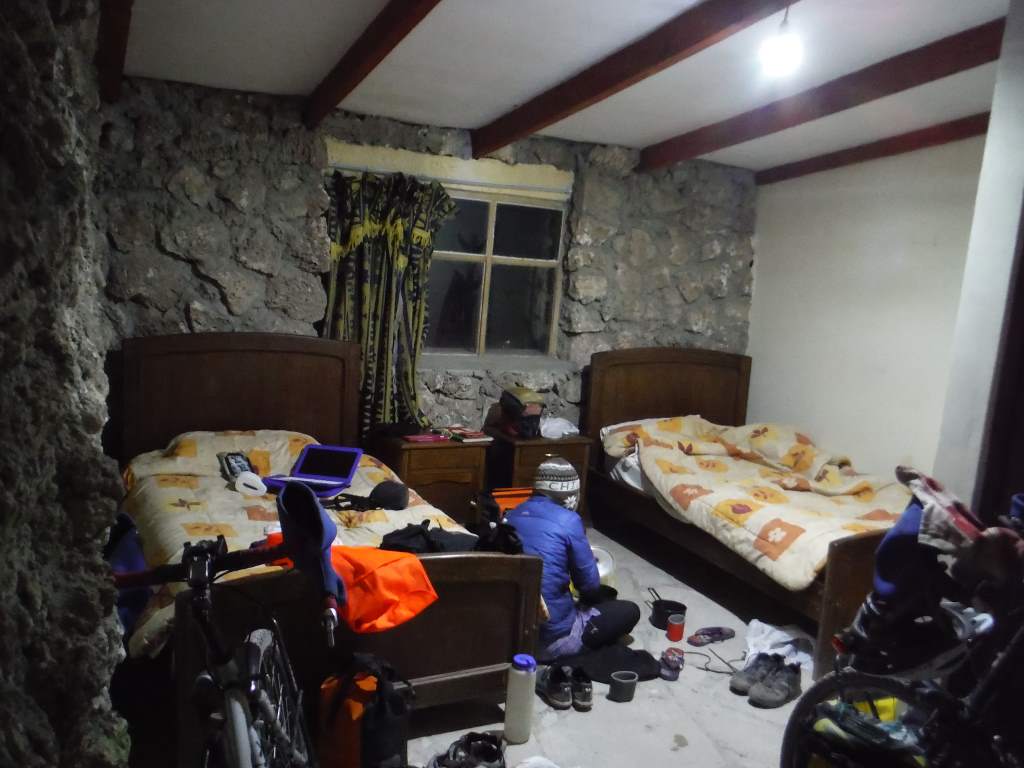
That night we stayed in the town of Salinas, which was a charming place with a beautiful plaza, friendly little kids, and very nice women selling fresh bread on every corner. We stayed in a hotel which was clearly not up to earthquake code, but luckily we made it through the night anyhow.

Apr29_001


After Salinas we made fast time across the flats on good roads. We wanted to stay in more small towns, but the lodging options were abysmal or nonexistent so we had to camp. One night we had a wonderful campsite next to a river, and the next night we had a desperation sort of campsite along the road.

Quinoa statue!

Quinoa statue!

Apr29_003 Apr29_013

You see, we had planned to stay in the mining town of Poopo (funny name, right?). Poopo claimed to have a resort-style hotel next to a semi-olympic swimming pool, so we headed in to town after a long day of 70 miles riding into a headwind. We arrived at 4:30, but no one was at the hotel. A nice guy on the street called the number on the door for us, and learned that the attendants were watching a soccer game and would arrive in an hour. That sounded ok to us, so we just waited around for a bit chatting with the Kiwis. An hour and a half later… no movement. We got another nice guy to call for us, and the attendants said they’d be there in an hour. Uh oh. At this point it was starting to get dark, and we really didn’t like the sound of things. We asked the ladies at the pool if we could camp there – NO. We asked the city government people what to do, they said we should just wait. We asked the police if there was another safe place to camp, they told us to put the tent up in the street in front of the hotel!

A hotel we don't recommend.

A hotel we don’t recommend.

We were shocked and a bit sad that no one would help us, so we just got on our bicycles and rode out of town. It is never fun to set up camp in the dark, but we managed. It helped that there were four of us. We found an out of the way spot and settled in. Remarkably, it was a quiet night, and no one bothered us a bit. New rule: if we’re not in the hotel by 5:00 we move on and find a good place to camp! It gets dark around 6:15 here.

Now we are in the big city of Oruro. Our guidebook warned us that it was a gritty place without any good food, but we have found the opposite to be true. The streets are full of life here, and we spent all morning wandering around huge street markets. They are very different from the markets in Mexico: much quieter, with less yelling and a lot less food. We are learning to bargain a bit, but mostly just gawk at everything and everyone. In three more days we’ll be in La Paz, which is legendary for its markets. We are very excited!

Now, a few more photos that didn’t make the narrative:

Small town in Bolivian Altiplano

Small town in Bolivian Altiplano

Quinoa, up close and personal.

Quinoa, up close and personal.

Us and the Kiwis!

Us and the Kiwis!

Welcome to Bolivia: Scenery, altitude, and roads in the sand

famblog_lagunasThe last nine days of riding have been by far the most difficult of the trip.  Of course, they have also been among the most scenic, otherworldly, and downright surreal.  Leaving San Pedro we climbed 7,700′ (2260 m) and entered Bolivia, country number six.  We then proceeded to spend the next five days above 14,000′ (4300 m) as we rode very slowly through the Bolivian Lagunas.  Up here in the altiplano we have seen too many llamas to count, a string of colored lagoons, snow-topped volcanoes, hot springs, tiny villages, and even other cyclists.  As you will see from the photos, this is adventure riding at its best.  What you won’t see from the photos is how brutally hard it was.  I will try and include some stories about that in the narrative!  Note, this post is a tad longer than normal with a ton of photos.  What can I say, it’s been an incredible section of riding.

How could we skimp on photos when the scenery is this good?

How could we skimp on photos when the scenery is this good?

Leaving San Pedro was exciting for us, even though our bikes were heavily loaded with eight days worth of food and two days worth of water.  It was only 28 miles (45 km) to the top of the climb, but it would take us a day and a half.  The road wound up and up the same hillside, so our entertainment was in watching the huge Volcano Licancabur draw slowly closer.  Some sections were so steep that we were forced to push the bikes for miles at a time.  Even pushing, we could hardly go more than a tenth of a mile without resting to catch our breath.  We called it a day after only 20 miles (32 km) and made camp.

The climb is straight up that wall just to Jason's left.

The climb is straight up that wall just to Jason’s left.

I got a new safety vest before leaving town.

I got a new safety vest before leaving town.

A fantastic spot for lunch.

A fantastic spot for lunch.

Up up up.

Up up up.

Jason looks classy in my jacket...?

Jason looks classy in my jacket…?

A pretty scenic spot to spend the night.

A pretty scenic spot to spend the night.

Vicunas (like llamas but wild) near the top of the climb.

Vicunas (like llamas but wild) near the top of the climb.

The next day we triumphantly finished the climb, topping out at 15,300′ (4665 m).  It was cold and windy up there, so we were glad to turn downhill and enter Bolivia.  We were granted 30 day visas by the friendly border guards and we rode off along a sandy road into a national reserve of Andean fauna.

Country number SIX.

Country number SIX.

Downhill (for a bit) into Boliva.

Downhill (for a bit) into Boliva.

Seagulls at 14,000'.

Seagulls at 14,000′.

Apr17_014That first night we spent in a simple refugio with warm blankets. Even inside our room  it was near freezing.  Up here the nights are incredibly cold  despite being technically in the tropics.

The next morning we set off into the sand to make our way around two lagoons, over an even higher pass, and finally to a thermal pool for a bit of relaxation.  Riding around the lagoons involved choosing our own path among the many sandy tracks created by tourist jeeps. It was a bit like a choose your own adventure book, but more “choose your own torture”, as most of the tracks alternated between jostling us senseless and sucking our wheels into deep sand.

Apr18__005 Apr18__006 Apr18__008

Apr18__011Eventually we joined a more major track and started a slow climb back up to 15,300′.  As we climbed we started to see bicycle tracks, and as we neared the top a pair of large, slow moving rocks became two cyclists!

After a brief chat with Anna and Ernesto, two young  Brazilians, we agreed to meet at the upcoming thermal pool.  What a wonderful pool it was too! Way up high in the frigid plains a volcanic hot spring bubbled up, creating both a tourist destination and a warm oasis for flamingos. We were allowed to sleep on the floor of a nearby dining hall, and had a fantastic soak with our new friends.

Apr18__012

Two little cyclists appear in the distance.

Two little cyclists appear in the distance.

Apr18__019

Soaking in the thermal pools.

Soaking in the thermal pools.

Spring-fed lagoon at sunrise.

Spring-fed lagoon at sunrise.

We left our new Brazilian friends behind after the hot springs.

We left our new Brazilian friends behind after the hot springs.

Pushing slowly up.

Pushing slowly up.

The next day was a true challenge.  In the morning we wound our slow way up a high pass.  When I say ‘high’ I really mean it: we topped out at 16,200′ (4940 m).  We were gasping for air and fighting a vicious cold headwind.  The plan was to descend nearly 2,000′ (600 m) before camping, but the road surface became absolutely horrible and our progress slowed to a crawl.  We were forced to camp at 15,600′ (4750 m ) in the inadequate shelter of a dirt pile.  As soon as the sun set the temperature plummeted.  We wore all our clothes, zipped the sleeping bags together, and settled in for a shockingly cold night.  Just before dawn our thermometer read -6 degrees F ( -22 C).  Our breath had created ice on the sleeping bags themselves, and any water that we hadn’t brought in the bags with us was frozen solid.  Mostly, we were just happy to have survived.

Can you find our tiny tent?

Can you find our tiny tent?

Freezing cold in the morning.

Freezing cold in the morning.

After that unreal night we took two very short days to recover some strength.  There were more sand roads, more lagoons, flamingos, and llamas.  We spent two more cold nights in the tent, but nothing approaching the dangerous cold of that one night.  Some pictures from these days:

Apr20__005 Apr20__009 Apr20__010 Apr20__014 Apr21__001 Apr22__006

On our sixth day in Bolivia we finally descended from the very high plains to the high plains.  It was a lovely ride down a canyon populated by llamas and tourists in jeeps.  At the bottom we rode through a wide valley to a small village.  It was with great excitement that we found beds in a simple hostel. For dinner the hostel owner made us delicious llama steaks and vegetable soup.  Finally we spent the night warm and snug in real beds.

Apr22__007 Apr22__010

So many jeep tourists drive through here, stopping only to get a handful of photos.

So many jeep tourists drive through here, stopping only to get a handful of photos.

Apr22__016 Apr22__018

Our first Bolivian village in the background.

Our first Bolivian village in the background.

The next day we descended even further to 12,600′ (3800 m).  The air here was starting to feel thick and oxygen rich!  Just outside the next village we met two more cyclists: Emma and Debbie.  They are two women from New Zealand on a 6 month trip  and they are tough as nails.  We had a great evening with them in another hostel, and they convinced us to take the flat road into the next major town.

Quinoa fields in Bolivia.  It's hard to believe we're actually here.

Quinoa fields in Bolivia. It’s hard to believe we’re actually here.

Apr23__010 Apr23__009

Four bikes at a hostel.

Four bikes at a hostel.

A quiet Bolivian village.

A quiet Bolivian village.

After a day of flat, fast riding we camped with them in a wide field, and the next day we rode together to the dusty frontier city of Uyuni.  After nine days of truly remote riding, we were all overjoyed to enter a full service city.   Together we did an extensive hotel search before settling on a backpackers hostel.  Sure, it is a bit pricey ($10 US per person), but the bunks are comfortable and warm, breakfast is included, and the internet actually works!

We are resting for a day here and enjoying our time with Emma and Debbie.  They are super fun and have tons of good stories.  Tomorrow we will leave this comfort to start another iconic adventure: riding the Salar de Uyuni, the world’s largest salt flat.  It might be a bit before we can update (again). Maybe that’s the new norm for us now that we’re in Bolivia!