Author Archives: Jason

Laza to Cea – “Galicia Profunda”

In the words of Daisy’s Spanish host father Javier, we are now in “Galicia profunda” – deep Galicia. The Romans never conquered this area due to the challenging terrain – but we made through!

Day 21: Laza to Xunqueira de Ambia (35km). After leaving town this morning we stopped under a tree to check the map for our first turn. That was when Daisy got pooped on by a bird! I maintain that it is a symbol of good luck and fortune. I’m not sure if everyone (or anyone) agrees.

The road quickly turned from flat-in-the-valley to climbing-up-a-mountain. The clouds were low and thick, but it wasn’t raining. Many yellow flowered bushes covered the hillside during the climb. Near the top the small town of Albergueria has a famous pilgrim’s bar where sea shells cover the walls and hang from the ceiling. We stopped for hot drinks to warm up. Several other cyclists came though – but they were moving a lot quicker since they had electric assist bicycles!

Climbing out of the Laza valley with a lot of yellow flowers
A bar with many shells, the symbol of the Camino

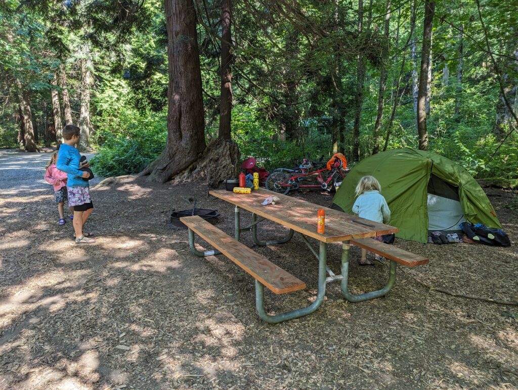
Next we went “downhill” with a series of many hills. The kids weren’t feeling great, with tummy pain, so we set our sights close and stopped in Xunqueira de Ambia. Daisy called the owner of Pension Casa Tomas, who was named Tomas of course, and who gave us the code to get into the hostal. We got a room with four beds and relaxed and relaxed. Later we went out to the grocery store for dinner supplies which got cooked in the microwave. (The kitchen was nearly nonexistent.) The store owner was very excited about our trip with kids.

H covers the Camino arrow sign. Will we know which way to go?
Displaying our snacks for dessert: chocolate cookies and fruit juice. They didn’t have any ice cream at this store.

Day 22: Xunqueira de Ambia to Cea (55km). Everything in Galicia seems green, green, green. And oh so hilly! Today we started by going mostly downhill to the big city of Ourense. We opted to get some prepared foods (bread, empanadas) from a grocery store for lunch. The store was next to a small park with perhaps the biggest playground we’ve seen so far! That went over quite well with the kids while the adults did a few chores.

Cool kids

The book-suggested route took us on a low-traffic road for the climb out of Ourense and we saw several other day-rider cyclists. We had some confusion about how to rejoin the main route / highway and decided to ask Google Maps for help. (At the mention of Google Maps you should be starting to expect a semi-disaster…) We’ve learned this lesson multiple times over the years, but somehow we always need to learn it again: ALWAYS check the roads Google cycling directions sends you on to make sure they are to your desired quality. In this case I didn’t check, and adventure ensued. The first kilometer was on a beautiful, paved road. We easily missed our turn because it was an overgrown gravel “road” / track. We then had the joy of needing to ford a stream with the bikes, ha! When we rejoined the main road we stopped at the first restaurant and enjoyed a most delicious raspberry cheesecake and laughed again at how Daisy put on her sandals to push the bikes across and through the stream.

Beautiful, quiet road
Quiet, questionable road
Oh no, I see the stream crossing ahead!

Daisy had booked us in what is essentially a small hotel in Cea for the night. Our evening walk was a blast through small alleyways and next to stone buildings and walls. The Galicians sure know how to work with stone!

Stone buildings and alley

Summary: Salish Sea Cycling Loop, 15 days (293 miles)

What a fun trip! We made a complete loop around the Salish Sea along the northwest coast of Washington and dipping into Canada. We started/ended in Bellingham, but of course you could start anywhere along the loop.

Here’s a list of where we stayed. You’ll notice we stayed in a lot of WA State Parks because they have hiker/biker sites for $12 total and you don’t need reservations in advance — they have a ‘no cyclist turned away policy’!
– Larrabee State Park
– Bay View State Park
– Washington Park
– Deception Pass State Park
– Fort Worden State Park
– Compass Rose Farm
– Sequim Bay State Park
– Dungeness National Wildlife Refuge
– Warmshowers host in Port Angeles
– Island View Beach Regional Park (Canada)
– Gulf Island National Park and Reserve, Smonećten Campground (Canada)
– Peace Arch RV Park (Canada)
– Birch Bay State Park
– Friend’s house in Bellingham

We were fairly heavily loaded. Daisy and A were on a tandem, but since H broke her arm at the start of summer she was on a trailer bike (Wee Hoo) with Jason. Between bike, gear, and kid, the setup was about 150 lbs each, plus the weight of the adult. Yes, somehow we managed to have about equal loads without weighing them until the end!

Birch Bay to Bellingham (27 mi)

Car-less roads near the refinery

This was the last day of our summer 2023 bike tour! After breakfast, the kids and Daisy went back to the beach to play while I packed up camp and the bikes. The Adventure Cycling Route in this area (Pacific Coast #1) takes you on several no-car roads by the oil refinery. This was a quiet, pleasant stretch of the ride. We did have a little trouble at one of the gates getting our loaded touring bikes past, though. This was easily solved by taking the bags off, pushing through the small gully, and reloading them again.

There were then some minor hills, but the more important characteristic was that it started to get hot and sunny. And due to that I started to wilt. (One of the things Daisy loves most about me, you can be sure, hahaha.) We stopped at a convenience store and dumped ice cold water on my shirt to cool off. That helped a lot! When we finally rolled into town we stopped at Wood’s coffee at Boulevard Park. This is a great spot to relax, and get some snacks and coffee. We finished the day by riding to a friends’ house, where we camped in their back yard. We got some much needed showers/baths (H excepted, who continued to be a dirty little monster, I guess!) and enjoyed poke bowls for dinner.

Beautiful Mt. Baker!
Getting really close now!
A’s way to celebrate
H’s way to celebrate
Philtron family completes the loop!

15 days and 293 miles later, we were back where we started. We had a great time on our Salish Sea Bicycle Loop!!

Next summer we are thinking about a loop along the Sunshine coast and Vancouver Island north of Nanaimo… TBD!

Peace Arch RV Park to Birch Bay State Park, USA! (20 mi)

Yum yum yum

Today we passed more blueberry bushes than I’ve ever seen before. It was farm after farm after farm! We stopped at one farm stand and bought the minimum, which ended up being about two dollars for two pounds. They must have made a mistake?! They were absolutely delicious!! As we continued on the low traffic roads, we took note of a very specific pattern: each farm had a mansion next to it. We coined the term “blueberry barons” and continued on our way.

“Blueberry Baron” mansion
Very very steep hill
Suburbia is more compact in Canada

We arrived at the border a little before lunch and due to a lack of signage waited in line with the cars. Luckily, this only took about 20 minutes to get through the line. Of course, when we got to the border agent he said: “Did you know you could just go in the building over there?” Although I wanted to say some choice words about how we obviously didn’t, I kept it to a polite “No” since he was a border agent. Across the border in Blaine we found a crappy grocery store and an ok pizza place in the shopping center we targeted for lunch. We were excited to get back on the road and arrive at Birch Bay.

Birch Bay snacktime

Upon our arrival we stopped at a convenience store for a well-deserved ice cream snack. The town of Birch Bay is small, but there are a few tourist spots and the bay is beautiful. At the state park we asked a couple of volunteers for help finding the hiker/biker sites. Unfortunately, the two sites were inadequate: one was occupied by what looked like a long term resident, and the other didn’t have a large enough flat spot for our tent. We went to the regular campground loop and found a spot. While the girls got set up I went to pay at the campground’s check-in ranger station. We ended up paying the regular hiker/biker rate instead of full price, because the manager/ranger there has that policy. A pleasant surprise! The girls splashed in the bay while I cooked dinner. We had a relatively uneventful last night of camping before returning to Bellingham tomorrow.

Campsite in Birch Bay State Park
Walking to the beach
Calm water