For our fall break we started in Walsenburg and rode three days up to Cuchara Pass and another day back down. Besides testing our gear, there were three things we wanted to go up against for practice: a strong headwind, a mountain pass, and gravel roads. All three of these will meet us in Tierra del Fuego. Luckily for us we got to try all three – at once! After the first day we weren’t sure we could do it, but by the end of the third day we were much more confident.
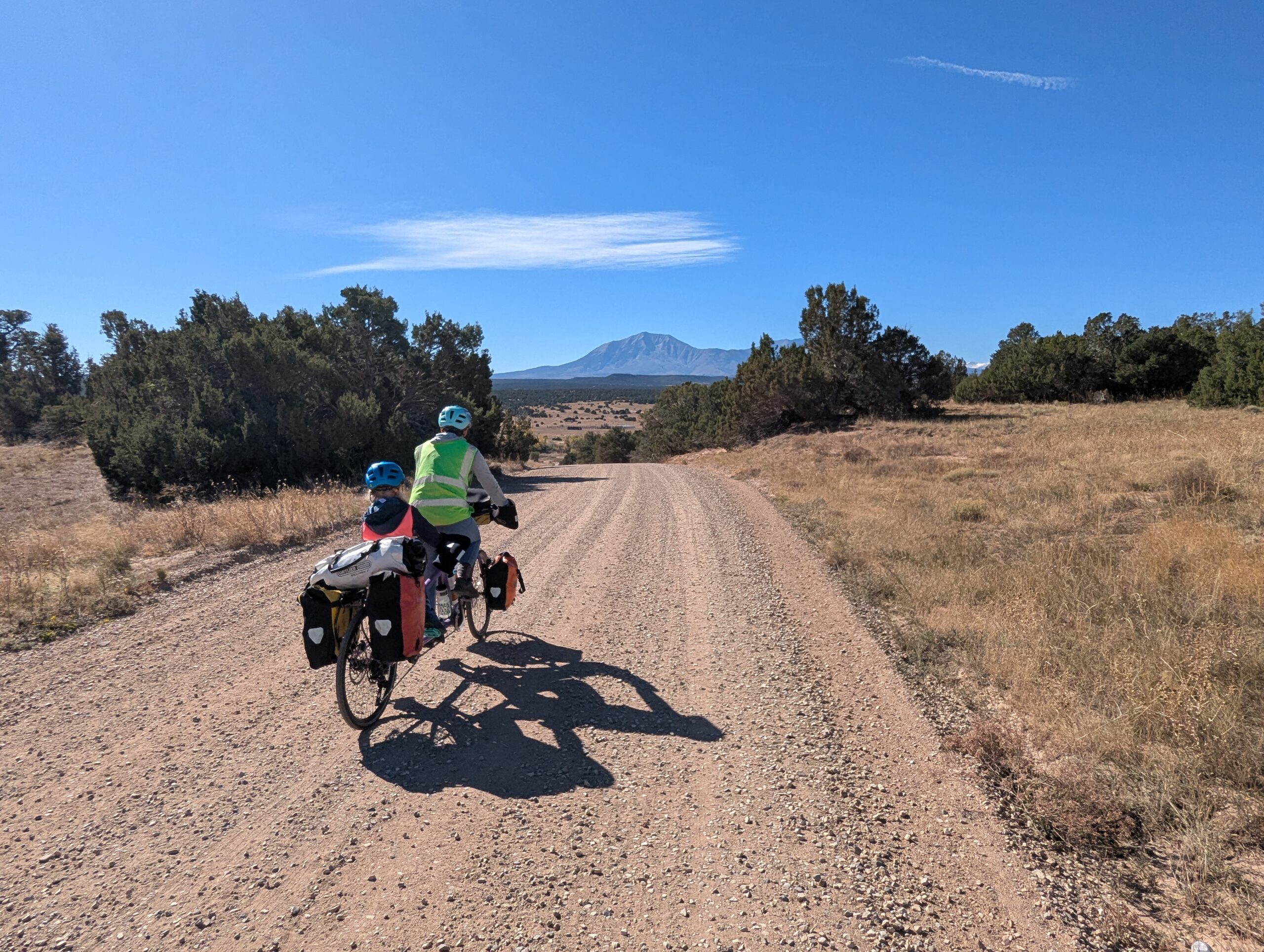
Day 1, Lathrop State Park to La Veta (15 miles, 900′ climbing, dirt): We camped overnight at Lathrop State Park and left our car there at the visitor’s center. We got on the bikes and headed out after a breakfast of chocolate chip pancakes. The first day’s ride took us across gravel roads to La Veta. We enjoyed the low-traffic road as it wound past deer, prairie dogs, pronghorn, cattle, and even a herd of horses that galloped across the road in front of us.
However, we had to work hard the whole time to fight the headwind. It was 20-30 mph! Tierra del Fuego is also known for very strong headwinds. How fitting!
As we came into town we checked the weather. The overnight forecast was 30-40 mph winds with 75(+) mph gusts. We abandoned our plans to camp (at the for sale Sammie’s Campground) and got a room in the La Veta Inn instead.
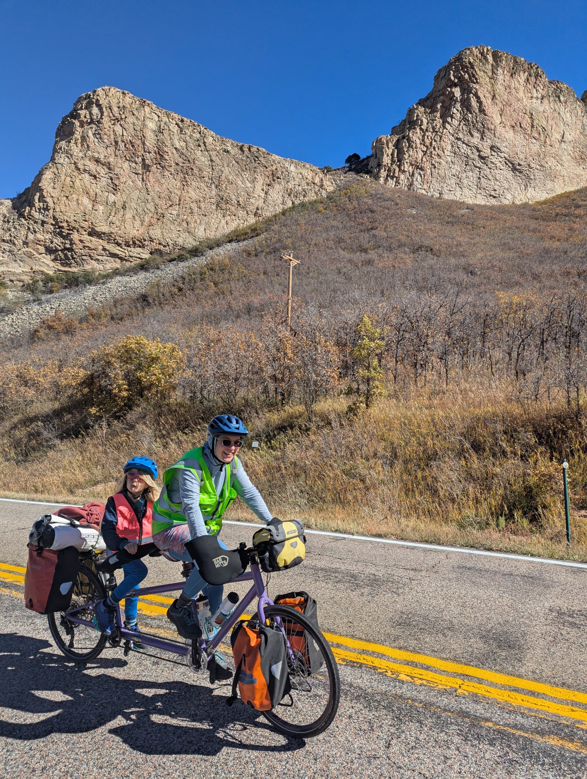
Day 2, La Veta to Cuchara (12 miles, 1400′ climbing, pavement): Whoa was it windy! We waited until after 10 AM to get on the road so the winds would die down. Today we travelled on pavement, but the headwinds continued. It was up, up, up the whole way. We passed several different rock formations. There are hundreds of rock walls that radiate away from the Spanish Peaks. The yellow aspens added some unexpected color to our late October ride.
Riding past the “Devil’s Steps”
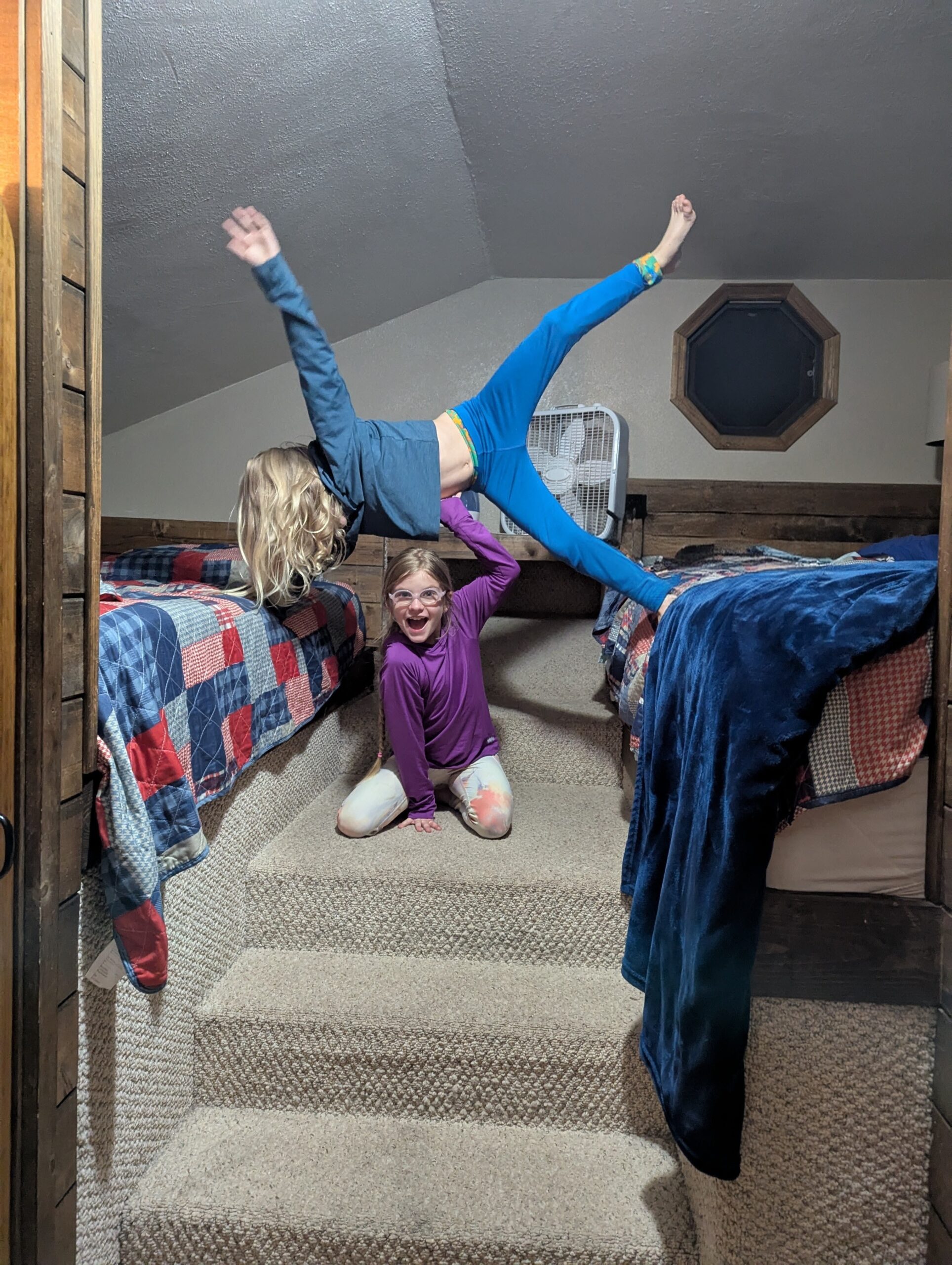
Cuchara is a cute “town” that is simply a block-long collection of stores for tourists. We stayed in a B&B and the kids had a blast playing in the attic-like second bedroom. There was a playground in town, but very few kids.
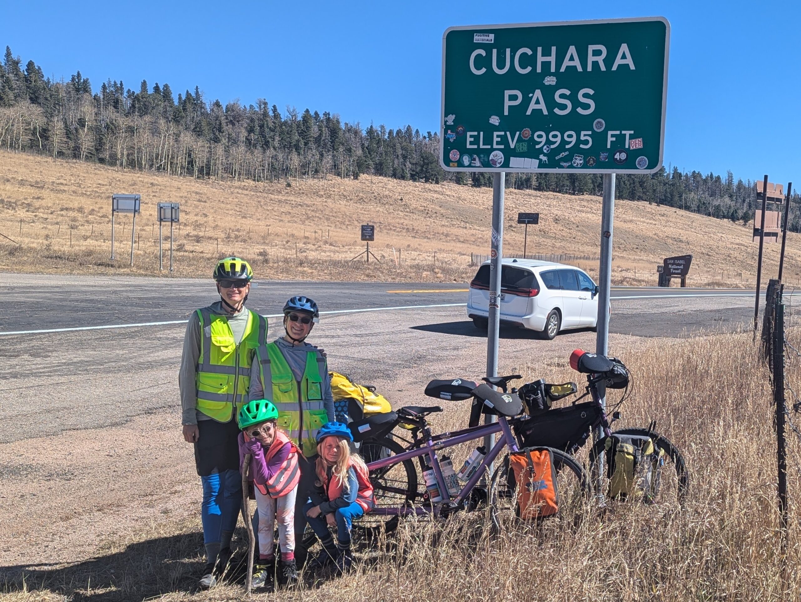
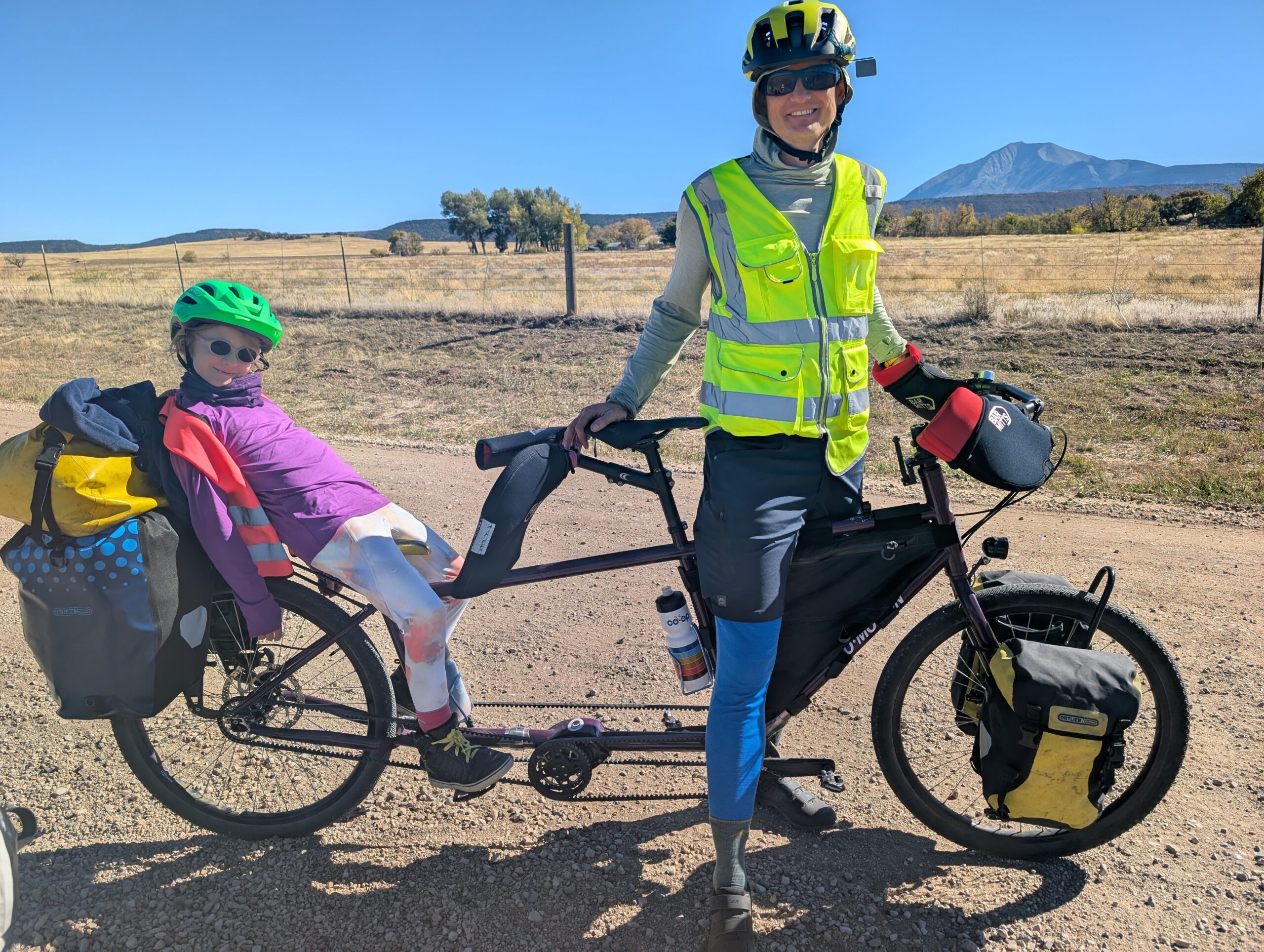
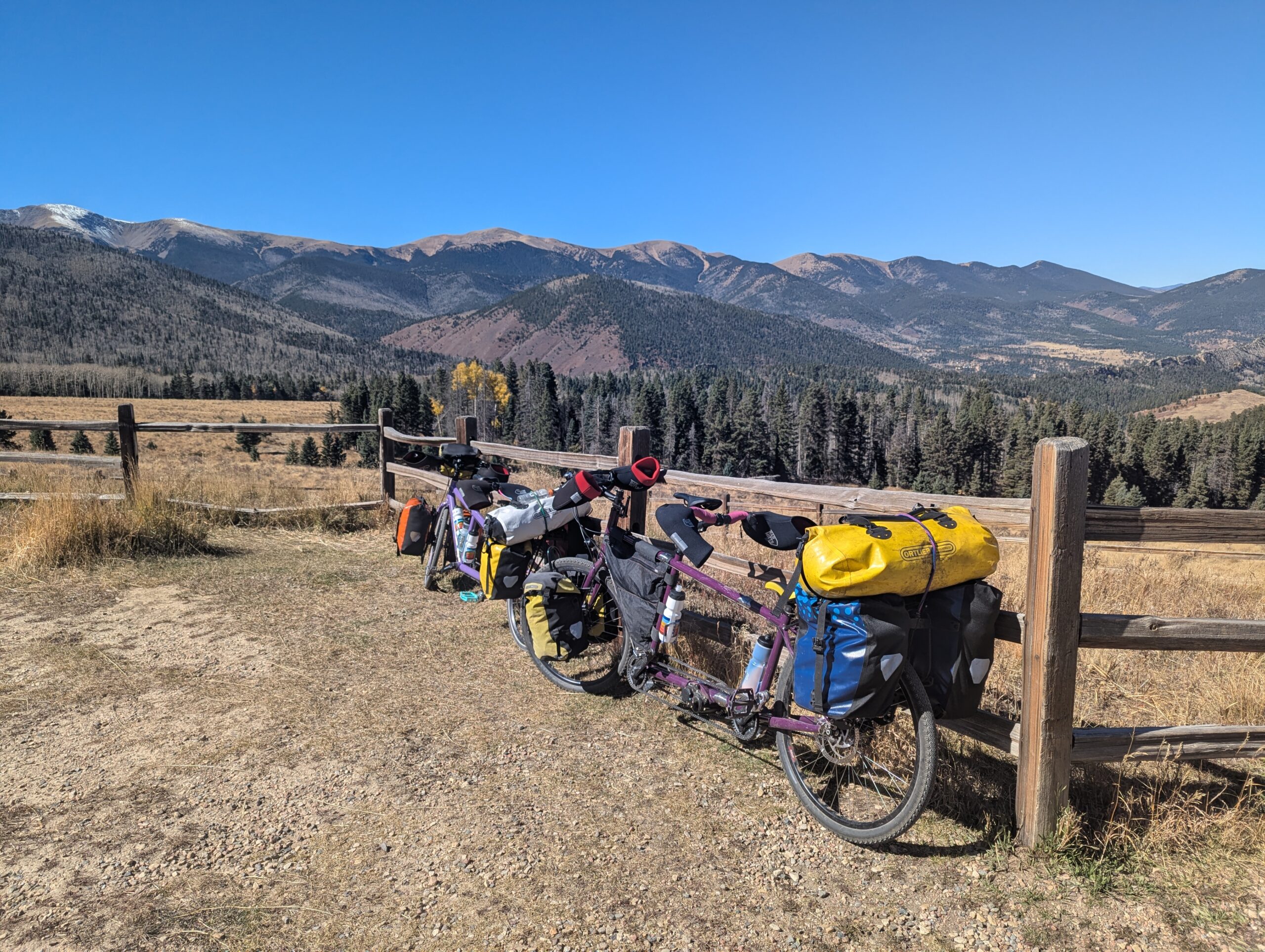
Day 3, Chuchara to the pass and back to La Veta (6 miles and 1500′ up, 18 miles back down): The B&B’s breakfast was great – we all ate a lot. I (Jason) had an extra (third) muffin on the way out the door and that really powered me up the pass. It was 6 more miles to the top of the paved road. The headwind was not so strong, and the road got steeper. At the top we took our obligatory photo with the pass sign, then continued up a little further (above 10,000′!) on a dirt road to a wildflower overlook.
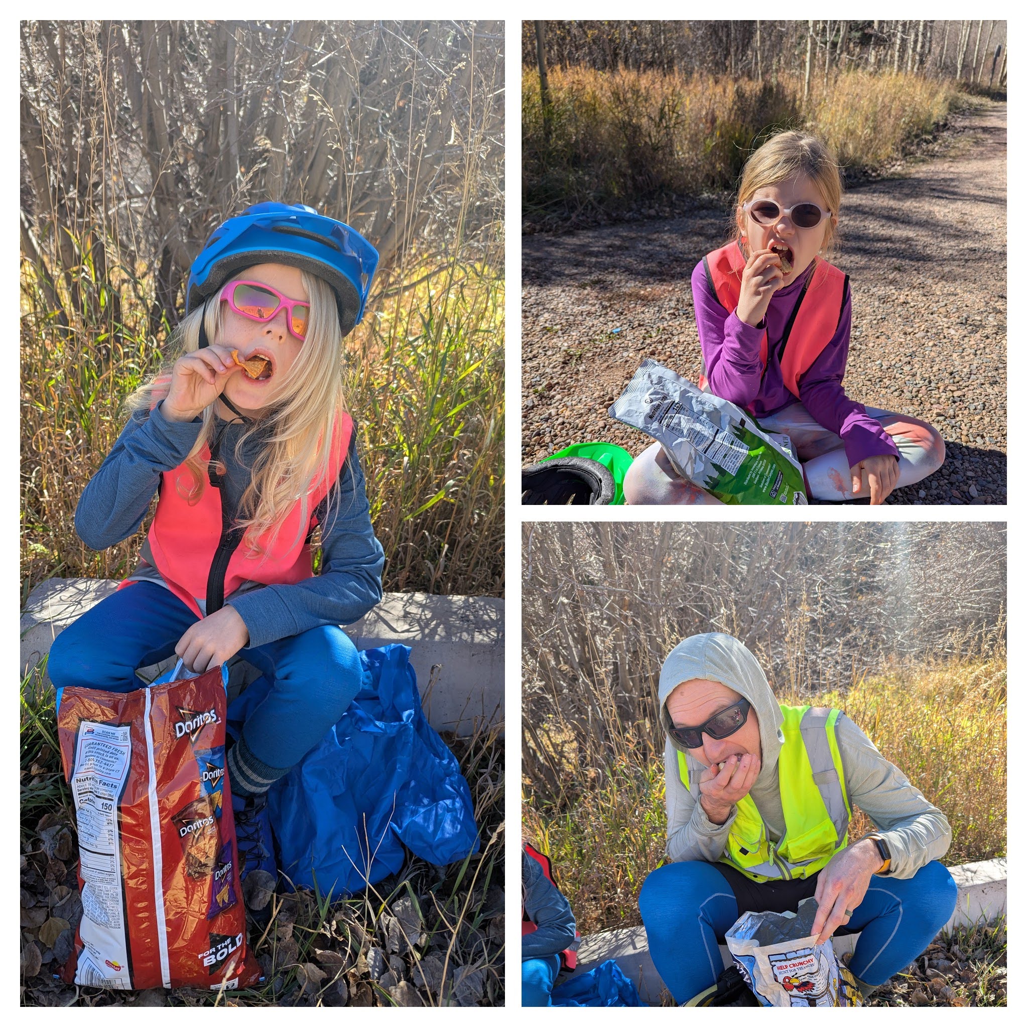
Snacktime is serious
We decided to head back down to prepare our lunch in the park in Cuchara while A and H played on the playground. Needless to say, it was a lot faster to go down than up! After a family conference we decided to go back to the La Veta Inn to spend the night in our “favorite room.” We realized that we were carrying our full set of gear on the bikes – including tent and pads and bags – but didn’t camp at all.
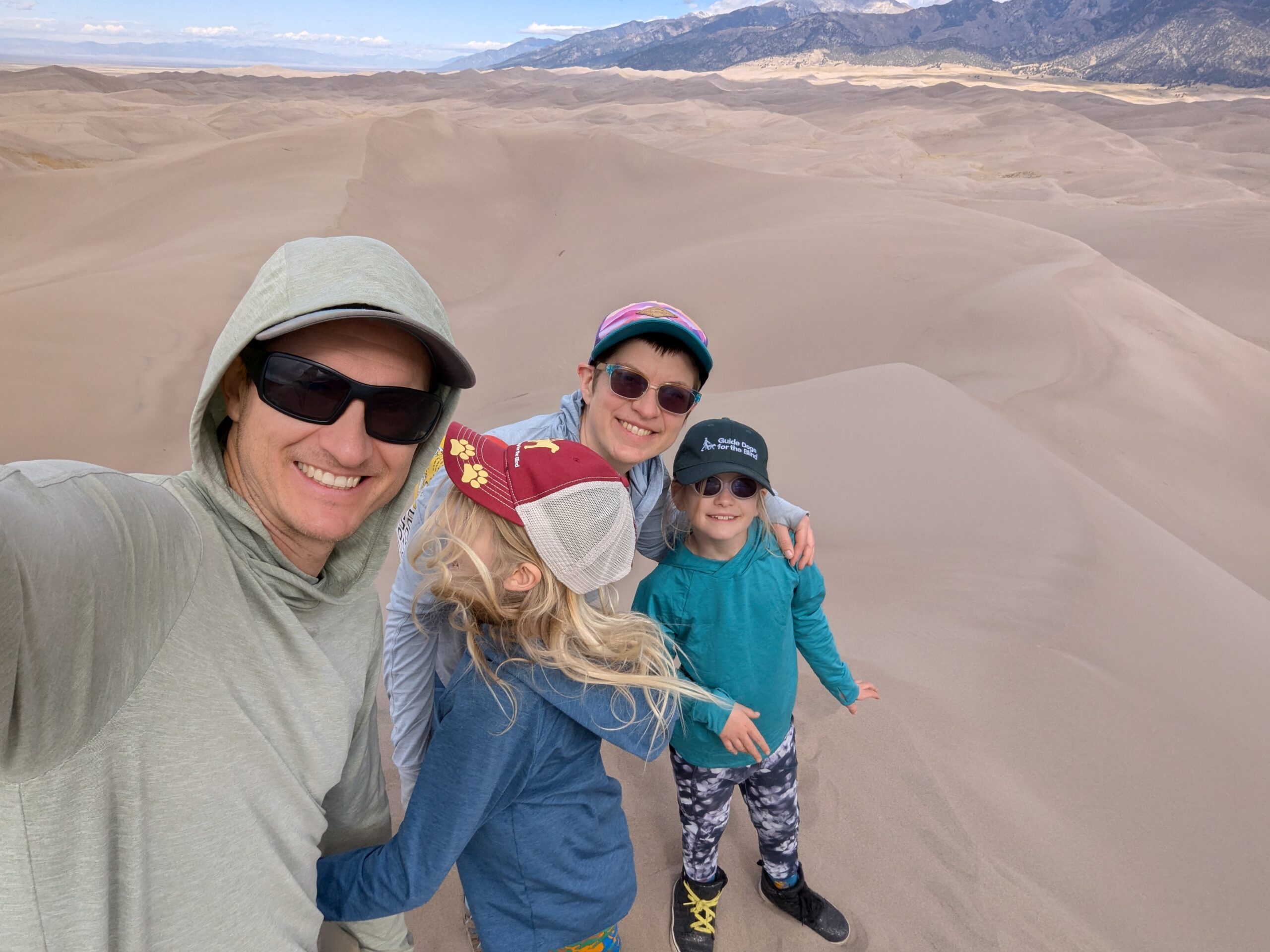
Day 4, La Veta to Lathrop State Park (15 miles mostly down on dirt): We took the same gravel road back down to the park. Somehow the wind shifted so we could have a little bit more headwind before our trip was complete. Our car was waiting for us and we ate lunch at the picnic tables in the park. We packed up and drove west to enjoy our first visit to the Great Sand Dunes National Park. Gear check = Success!
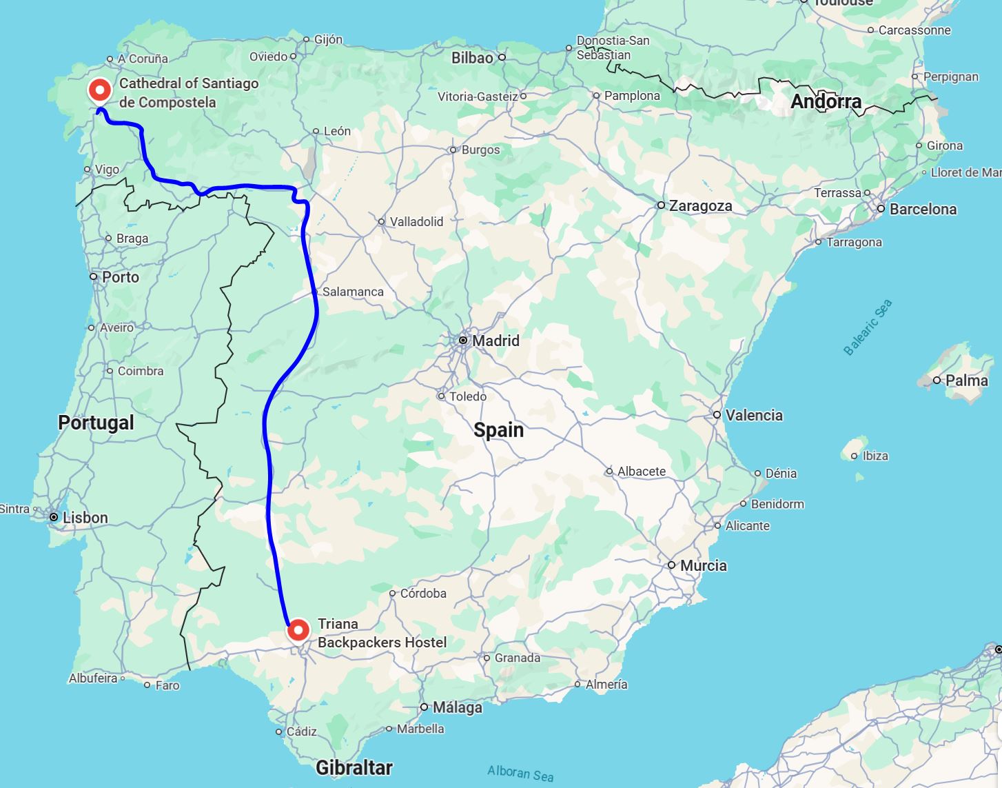
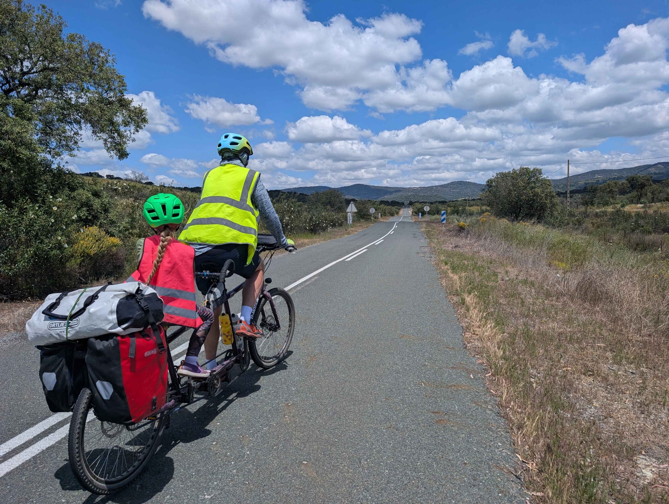
The Camino de Santiago is a pilgrimage route that is in fact many routes. We did the Via de la Plata, which was historically a trade route. We started in Sevilla, a city in southern Spain, and ended in Santiago, in the northwest corner. It took us 24 days total to travel 1007 km (627 miles). A ‘typical’ day was about 50 km (31 miles). The scenery was pretty and varied, and the Spanish people were friendly. There were plentiful services for cyclists, and drivers were very careful with us. We would not hesitate to recommend this route to other families or casual riders. It was quite different than our usual preference for camping in remote areas, as we didn’t even bring a tent! It was also a bit of a logistical challenge, but Spain has quite a bit of infrastructure built up around cyclists and hikers doing exactly this route.
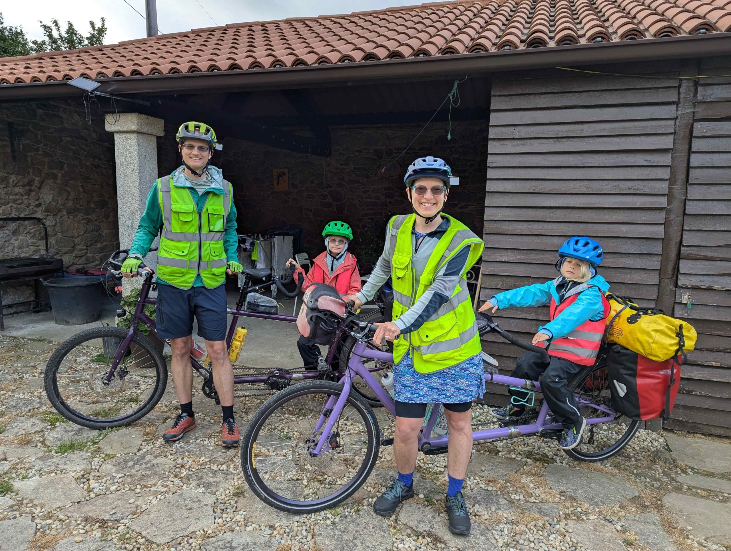
The Philtrons and their bikes on the final morning of the Spain tour
We used a guidebook for this route to keep us on low-traffic roads and trails. It included on and off-road directions and elevation profiles. The recommended days were usually too long for our family, but that didn’t matter. We used the website gronze.com to find lodging. Typically we booked rooms/hotels 1-2 days in advance. We stayed in communal bunkroom hostels a few times in the early part of the trip when there were few hikers on the route. As the hikers started to be more common we switched to apartments/hotels/rural houses. Hikers always have preference in the bunkrooms, which is fair.
It took days of research to get the logistics for this plan sorted out. I summarize how we did it here so that you don’t have to!
Logistical considerations getting to our start-point:
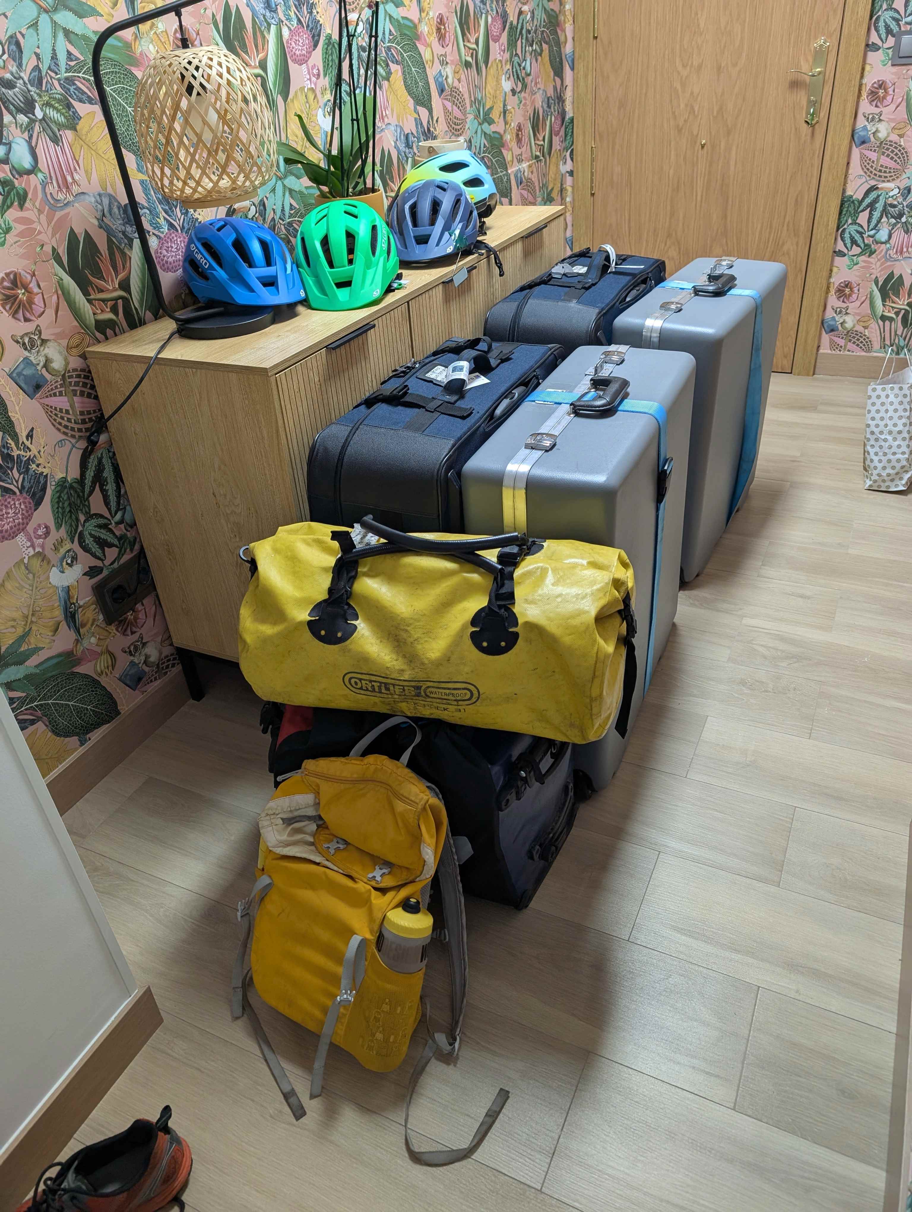
FLY: We flew into Madrid using United Card benefits to check the bikes, disassembled and in two airline-regulation-size suitcases each. We each carried on one or two panniers.
Regional train: The Madrid airport is connected to the high-speed rail terminal by regional train. We had to transfer once and the trains had about three steps up/down to get to from/to the platform. It was a challenge to move all the bags but we did it.
High-speed train: We took a 3-hour high speed train to Sevilla, which allowed us to carry our bikes and bags right on without issue. Honestly, the high-speed rail network was incredible.
Uber to hostel: A ten-minute UberXL carried us to our backpacker hostel, where we spent a couple nights to allow time to assemble the bikes.
Bike Bag Shipping: Here is the magic – Spain has a program (Pilgrim Pac) that allows folks to ship their bags to the end of this route, where they are stored safely until you arrive. We shipped the bike boxes from Sevilla to Santiago for about $40 each, including 30-day storage. The default is 15-days so you do need to add time
All of our gear ready for a plane ride. Or a train ride. Or an Uber ride.
Logistical considerations getting back from our endpoint:
Retrieving the bike boxes: As promised, our bags were waiting for us in downtown Santiago. We walked in, presented our ID and tracking numbers, and walked out with all our stuff.
Disassembling the bikes: We carefully chose an AirBnb at the end of the trip that provided us space to get the bikes back in their boxes. We had hoped to stay in a hostel, but many in Santiago don’t allow children.
High-Speed train to Madrid: Our high-speed train to Madrid was on time and efficient and accepted our bicycles, but it was stressful. Apparently the rules for bikes in boxes are contradictory for the train we chose and we needed special approval from a supervisor.
Regional train to hotel for overnight stay.
UberXL to airport: As before, the airline took our bike boxes without issue or charges.
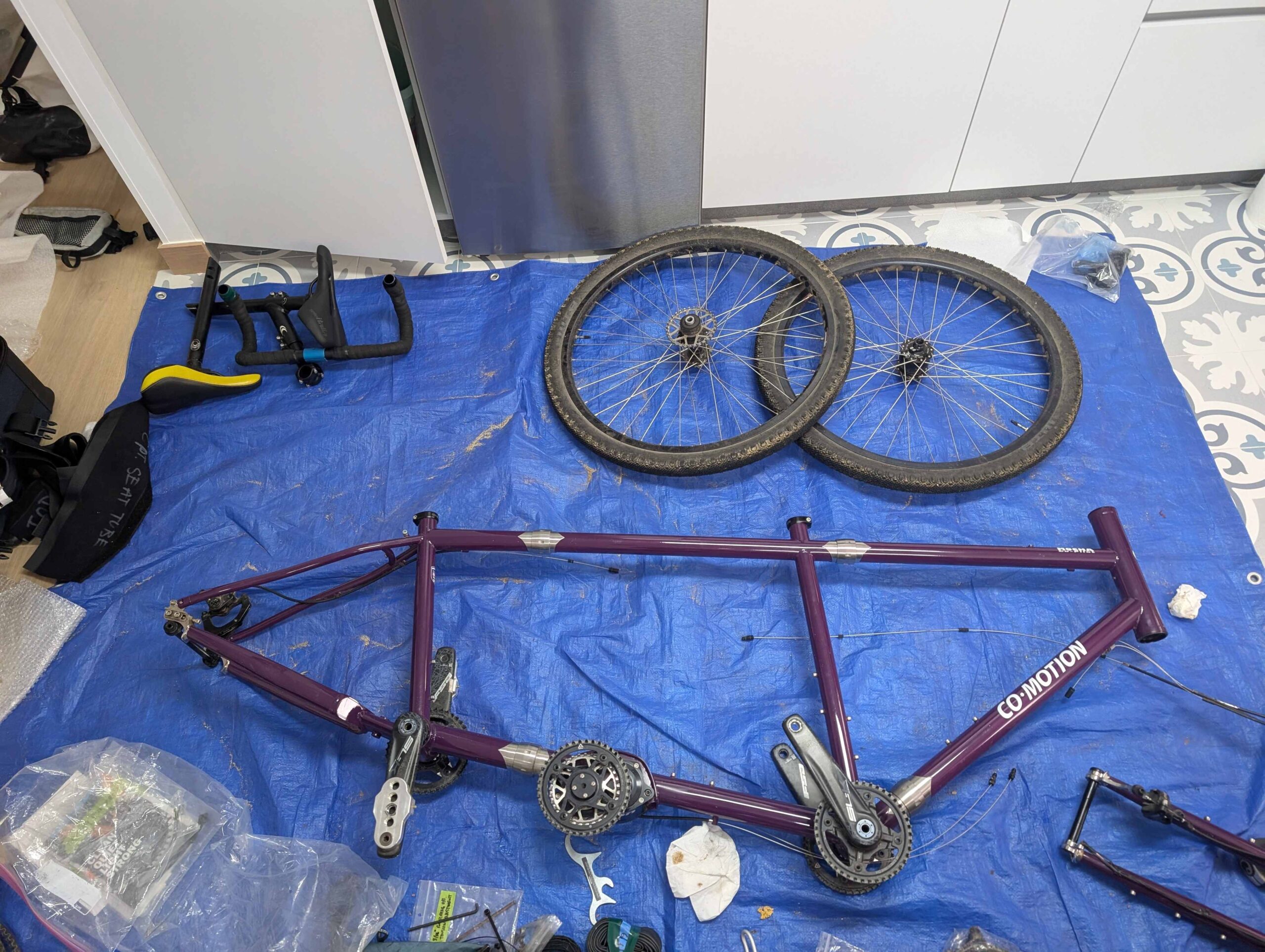
Jason’s bike at about 50% disassembly
Weather and Timing:
We had two days of rain and the rest was sunny and warm/hot.
You do not want to do this route in the summer. It gets dangerously hot. We started cycling mid-may and were done the first week of June. Even with our early departure (the girls skipped the last two weeks of school), we endured several hot days before entering the mountains. I would not do this trip in June-July-August.
Thoughts from our family on this route:
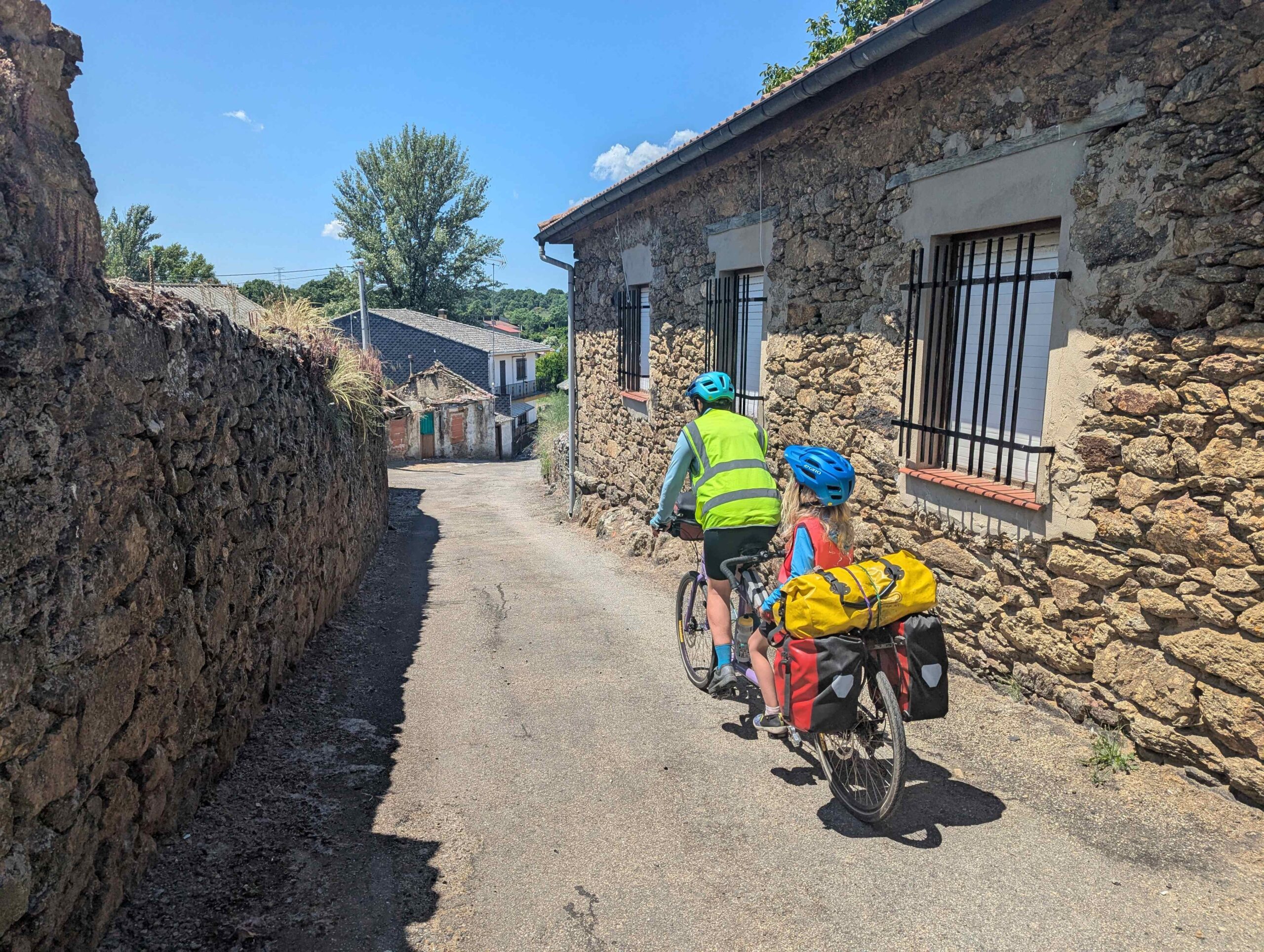
We stayed inside every night (no camping gear!) at a mix of private room hostels, shared bunk bed rooms in albergues (pilgrim bunkrooms), hotels, rural houses, and rented apartments. Calling ahead was important to ensure space for bicycles – especially if you’re on tandems. The guidebook often recommended staying in larger cities, but we found that we instead enjoyed the smaller towns. Our favorites were Zamora, which is highest on our list to come back to, and a village called Laza.
We struggled with the siesta – which in Spain lasts from 3 PM to 6 PM (about). If you arrive to town in the afternoon you may find that the only thing open are the bars. Nearly all businesses (grocery stores pharmacies, etc) close. Sundays were particularly challenging, when even the bars might be closed and nearly nothing opens in the evenings.
We loved the scenery, the quiet roads, and the historical towns. The girls noticed how the houses changed as we moved through different regions. Despite the comfort and lightweight setup that staying inside allowed, we all missed camping.
Thoughts about cycletouring with two elementary-aged kids
1. These kids are way tougher/more resilient than anyone on the outside could guess. They almost never complained about cycling stuff. They do need real rest days every 3-4 riding days. When asked what they would say to someone who thought 6 years old was too young for a bicycle tour… H replied ‘Who says that – I’ve been on more than 4 bike tours!’.
2. Entertaining them on the bikes can be a beautiful family experience or a patience-testing trial, depending on the terrain. When the riding was flat and easy we had so much fun singing and talking. When the hills were steep and the grown-ups were working as hard as possible it was so difficult.
3. I’ll never get used to having a six-year old poke my butt with her little fingers while I’m trying to just ride.
4. Piloting a tandem with a small child on the back also requires constant upper body strength. They wiggle! They point! We have to be constantly working to compensate and keep the bike upright. I had several days with very sore shoulders and arms, despite doing a lot of upper body work before this trip.
5. We ended up letting the kids have almost unlimited screen time in the evenings when it was an option. We asked a lot of them all day, and they wanted to just truly veg in the evenings. Every evening there was an obligatory family walk through town to see some sights, but besides that we let them read and play games.
6. Being an adult on a family bicycle tour is HARD. We have stuff for four people, and have to organize for four people, but only two people are really involved in the effort. The kids aren’t jumping up and down to pack, or organize, or cook, or choose food. They aren’t interested in doing their hair or brushing their teeth, or loading the bikes. We do it all. We pedal it all. The girls *do* help pedal, but their effort doesn’t quite equal their weight. It’s always easier to get up a big hill if the girls are off the bikes.
7. IT’S ALL WORTH IT. We are so grateful we had the health, the money, the time, and the audacity to do this trip.
Big sky riding on a warm sunny day
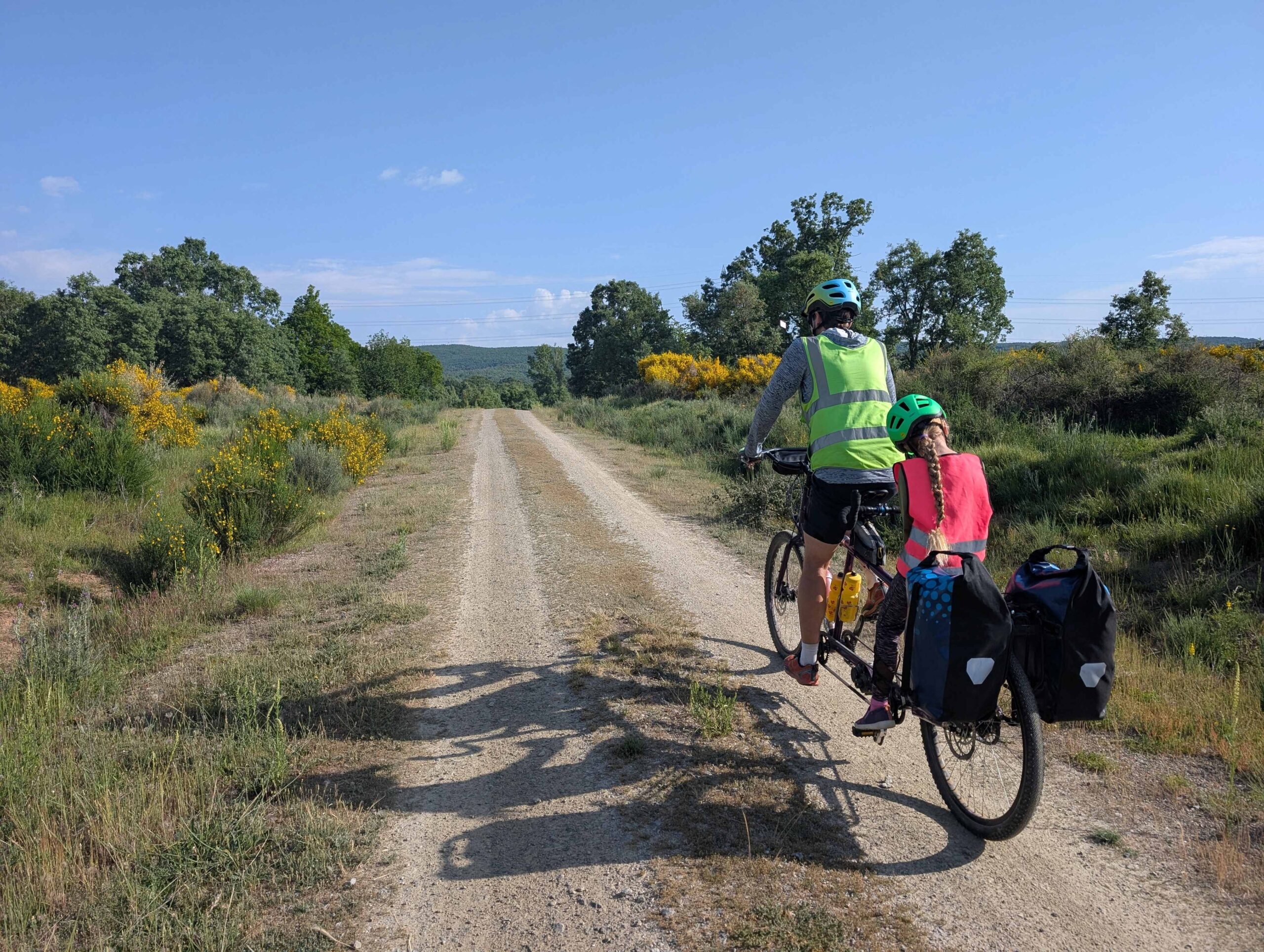
Riding through a villageExcellent riding on a quiet dirt roadRiding across a Roman bridge in a modern Spanish cityPushing and walking and persisting on a steep hill in the rain.
Our last two days of riding involved foggy and raining mornings. This was fitting considering how green it is in Galicia. We were very excited to make it to our destination, right on schedule.
Day 23: Cea to near A Bandeira (50km). Daisy and I started the day by leaving the hotel in search of the famous “Pan de Cea” (the local bread). After walking past the bakery (which of course just looked like someone’s house) we found it on the second try. The bread is a large loaf with a lot of fluffy in the middle and we can confirm it tastes good.
Visibility was very poor this morning, perhaps only 50-100 m. We dug deep in the bags to find the flashing red bike lights that we had carried the whole trip and were now using for the first time. The morning climbing left us wet from the rain. We were happy to stop at a bar to warm up. It seemed every passing pilgrim had the same idea. Unfortunately the lady wasn’t offering substantial food. Daisy identified a pizza restaurant in Lalín which raised our spirits and gave us a destination to push for. After warming up, and eating more Cea bread (with butter!) outside, we got back on our bikes and carried on.
Wet and foggy morning
Back on the road, we were excited to see a summit sign! You never know when the hill you’re climbing will be graced with one of these coveted and celebratory signs. When we came upon a second sign we were quite surprised, since it didn’t seem like we had gone uphill much at all for that one! And no, I know what you’re thinking dear reader, it wasn’t just because we were getting so strong.
Summit sign!Another summit sign! (There was barely a hill for this one.)Pizza lunch
There was high traffic on the N-525 after Lalín due to a closure on the main highway. We were not enthused, but did turn it into an opportunity to ride off-road for awhile. The route was absolutely gorgeous. Eventually we made our way to our destination for the night, a rural house where we rented two rooms. No one else was staying there, so we had the run of the 7-bedroom house all to ourselves, including the sitting areas and backyard pool. The kids insisted on swimming, even though it was cool, cloudy, and the water was not heated. That said, it didn’t take long for hot showers to warm everyone back up.
Biking on the Camino for a stretchSwimming in a cold pool in cool, cloudy weather
Day 24: A Bandeira to Santiago de Compostela (38 km). Since the house was super-fancy, our morning started with a catered breakfast of croissants, tostada, drinks, and spreads. The caretaker was very excited to check out our bike setup and happily took a family photo for us. Given our experience yesterday, we planned out a low-traffic route that was 8 km longer, but that would be less stressful. The morning ride was pleasant but uneventful until we stopped to get groceries. There was a bar next door called “Éxtasis” which initiated a discussion that caused us to almost miss that there was a grocery store!
Leaving our fancy country houseAnother palm tree!
Almost immediately after we got back on the bikes we needed to stop again to put on rain gear. The rain continued for hours. When A complained her feet were cold (or rather, that she was loosing feeling in them!) we stopped at a cafeteria to warm up. The kids got dry socks on, and a plastic bag before putting their feet back into their wet shoes. The mood was improved, and continued to improve, as we got closer and closer to our destination. We let Google Maps direct us on side roads today (but had vetted all of them!) and had no mishaps. Near the end we encountered some brutally steep hills, but soon enough rolled into the bustling city. We got situated in our rented apartment and celebrated our arrival! Daisy and I walked to the post office to pick up our waiting bike boxes and send-ahead luggage before it closed for the rest of the weekend.
Wet and chillyVineyard road
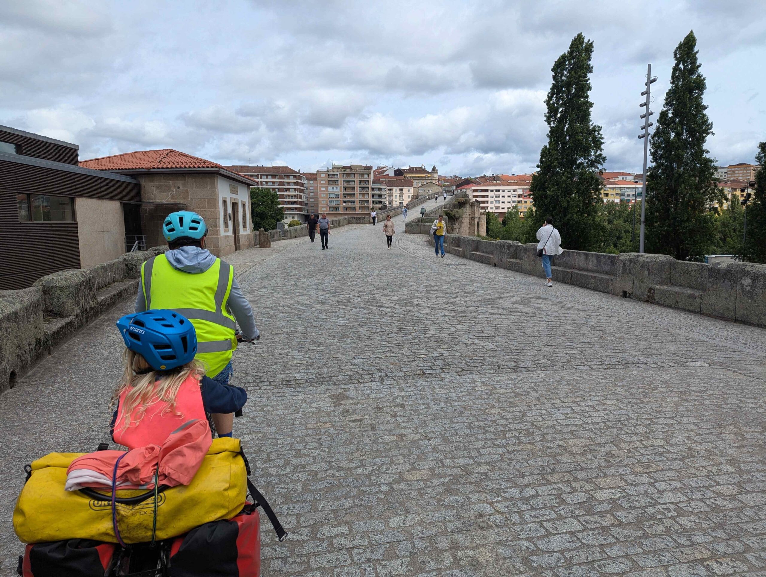
Day 25: Rest day in Santiago de Compostela (0 km). Today we walked to the main plaza with the cathedral for an obligatory photo shoot. The plaza was crowded and busy with tons of pilgrims and tourists. We found the Pilgrim Office and registered our journey. A and H got certificates printed out, which noted that we had travelled 1007 km! That official number coincidentally was the number of kilometers our route took us, too. After getting a few small souvenirs we went back to the apartment. We needed to complete our chores: to get both tandems packed up and to be ready for our train ride back to Madrid the next day.
The main square in Santiago, with the cathedral in the backgroundBeauty (H’s stuffy) insisted on doing a separate photoshoot with everyone to commemorate the 1007 km trip!
In the words of Daisy’s Spanish host father Javier, we are now in “Galicia profunda” – deep Galicia. The Romans never conquered this area due to the challenging terrain – but we made through!
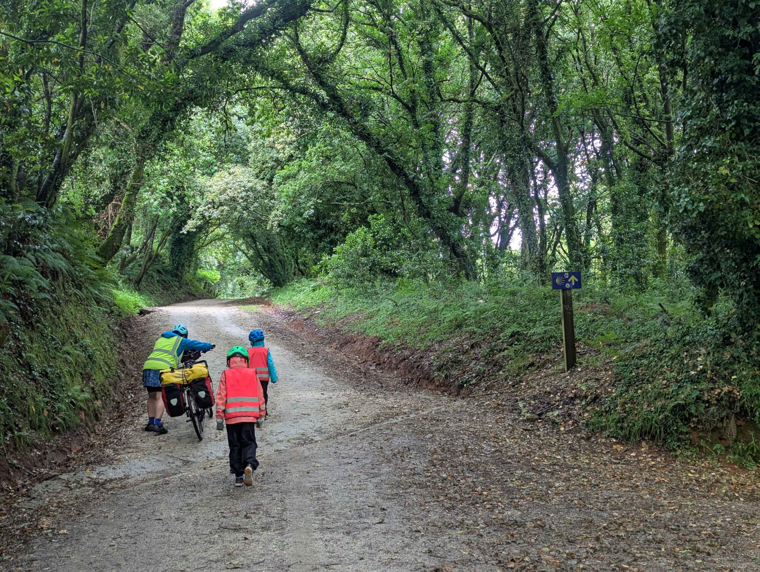
Day 21: Laza to Xunqueira de Ambia (35km). After leaving town this morning we stopped under a tree to check the map for our first turn. That was when Daisy got pooped on by a bird! I maintain that it is a symbol of good luck and fortune. I’m not sure if everyone (or anyone) agrees.
The road quickly turned from flat-in-the-valley to climbing-up-a-mountain. The clouds were low and thick, but it wasn’t raining. Many yellow flowered bushes covered the hillside during the climb. Near the top the small town of Albergueria has a famous pilgrim’s bar where sea shells cover the walls and hang from the ceiling. We stopped for hot drinks to warm up. Several other cyclists came though – but they were moving a lot quicker since they had electric assist bicycles!
Climbing out of the Laza valley with a lot of yellow flowersA bar with many shells, the symbol of the Camino
Next we went “downhill” with a series of many hills. The kids weren’t feeling great, with tummy pain, so we set our sights close and stopped in Xunqueira de Ambia. Daisy called the owner of Pension Casa Tomas, who was named Tomas of course, and who gave us the code to get into the hostal. We got a room with four beds and relaxed and relaxed. Later we went out to the grocery store for dinner supplies which got cooked in the microwave. (The kitchen was nearly nonexistent.) The store owner was very excited about our trip with kids.
H covers the Camino arrow sign. Will we know which way to go?Displaying our snacks for dessert: chocolate cookies and fruit juice. They didn’t have any ice cream at this store.
Day 22: Xunqueira de Ambia to Cea (55km). Everything in Galicia seems green, green, green. And oh so hilly! Today we started by going mostly downhill to the big city of Ourense. We opted to get some prepared foods (bread, empanadas) from a grocery store for lunch. The store was next to a small park with perhaps the biggest playground we’ve seen so far! That went over quite well with the kids while the adults did a few chores.
Cool kids
The book-suggested route took us on a low-traffic road for the climb out of Ourense and we saw several other day-rider cyclists. We had some confusion about how to rejoin the main route / highway and decided to ask Google Maps for help. (At the mention of Google Maps you should be starting to expect a semi-disaster…) We’ve learned this lesson multiple times over the years, but somehow we always need to learn it again: ALWAYS check the roads Google cycling directions sends you on to make sure they are to your desired quality. In this case I didn’t check, and adventure ensued. The first kilometer was on a beautiful, paved road. We easily missed our turn because it was an overgrown gravel “road” / track. We then had the joy of needing to ford a stream with the bikes, ha! When we rejoined the main road we stopped at the first restaurant and enjoyed a most delicious raspberry cheesecake and laughed again at how Daisy put on her sandals to push the bikes across and through the stream.
Beautiful, quiet roadQuiet, questionable roadOh no, I see the stream crossing ahead!
Daisy had booked us in what is essentially a small hotel in Cea for the night. Our evening walk was a blast through small alleyways and next to stone buildings and walls. The Galicians sure know how to work with stone!