Category Archives: Argentina

Ushuaia to Tolhuín

Day 1 departure

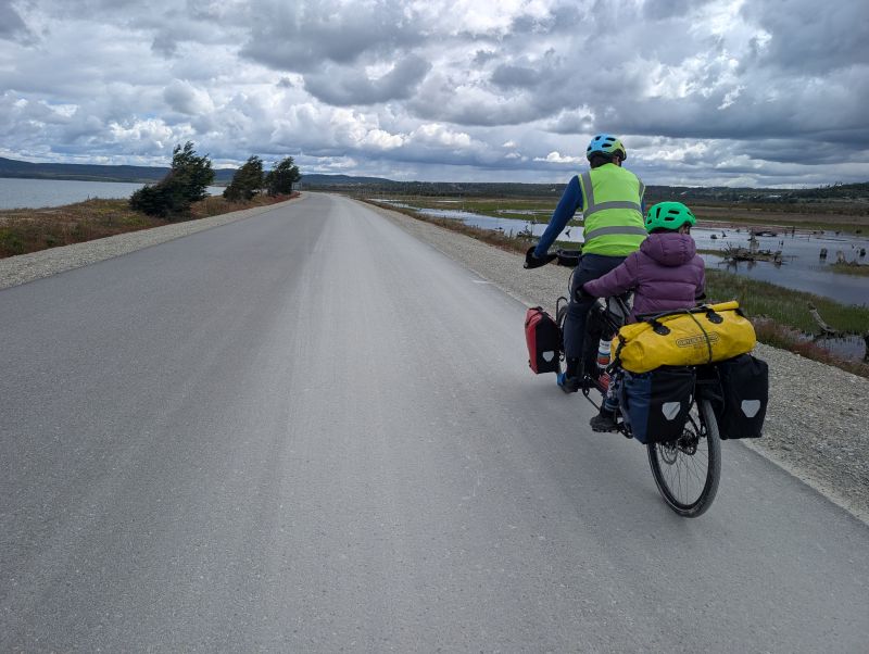
In this entry we travel from our start point, Ushuaia, to the next town, Tolhuin.  We enjoyed spectacular scenery and spent two nights wild camping. Everywhere we go the locals and other travelers are fascinated with and excited by our set-up.  They take pictures of us as we pass by, they stop their cars to check if we need anything, and once we even got interviewed on video for a local business owner!

Day 1: Ushuaia to camping near Cerro Castor (34 km)

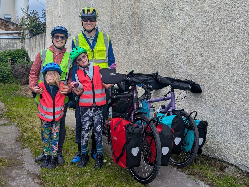
Our first day of riding had finally arrived!  The weather looked to be good for the next three days, so we left our AirBnB a day early.  Our hosts were absolutely lovely and came to see us off. 

Riding out of town

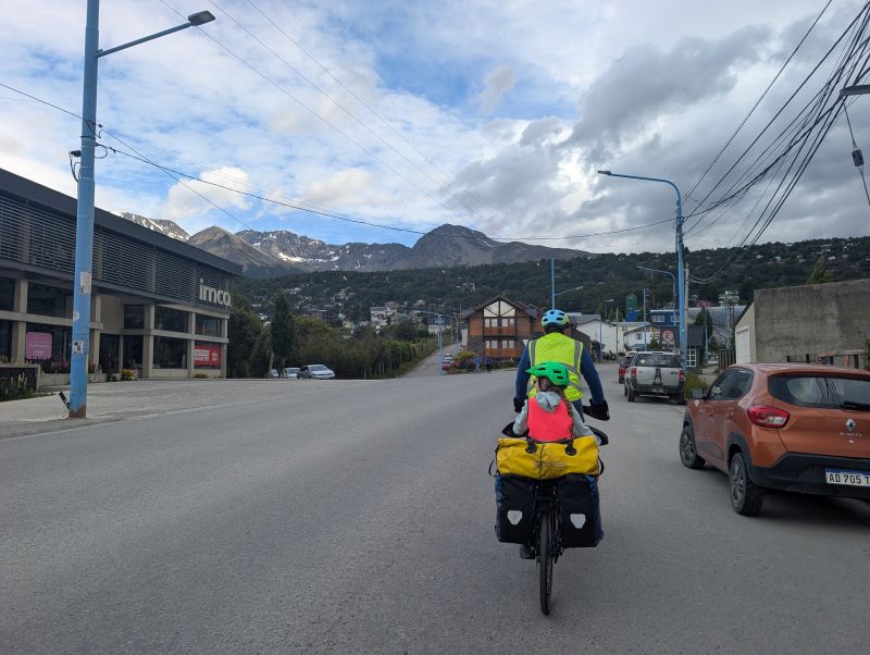
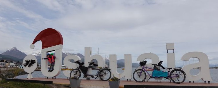
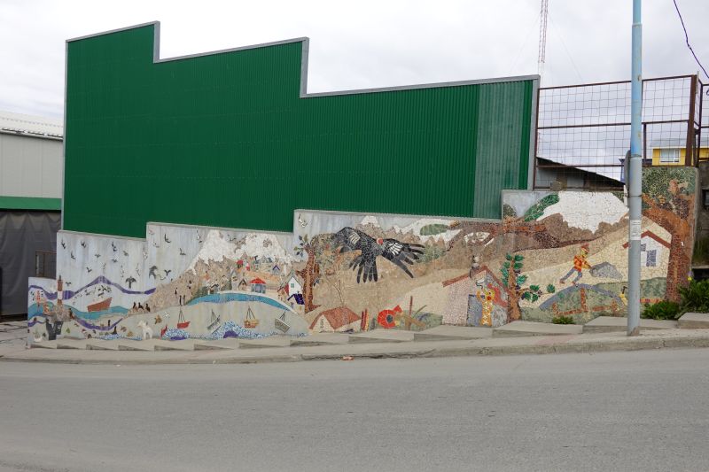
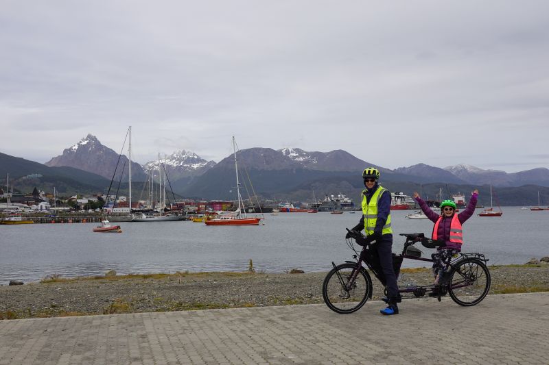
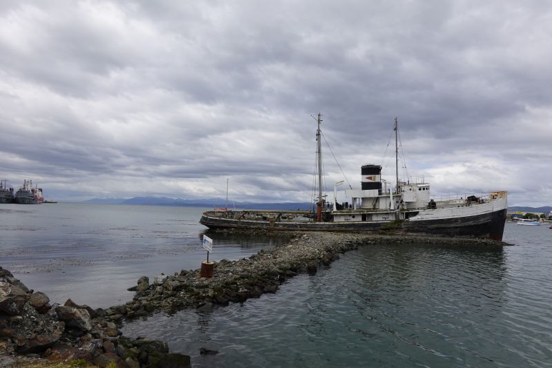
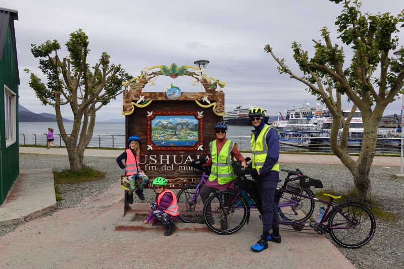
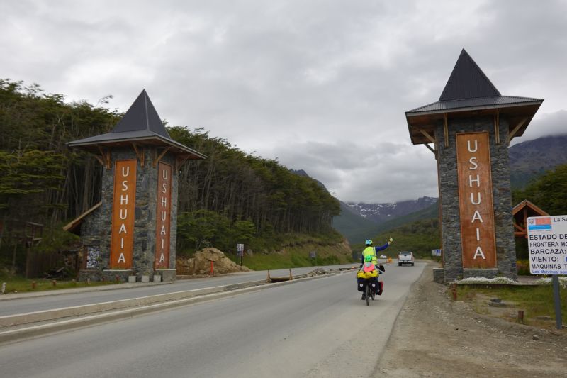
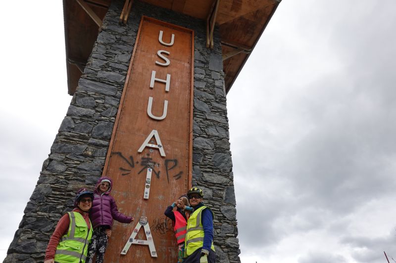
The road wove along the hillside above town for about five miles before we reached the famous “gates” of Ushuaia.  There was a very nice bike path all through town, which was a little more up and down than the highway, but a lot less busy!  When the bike path ended we were at the very edge of town.  We stopped for a snack and to take photos of the welcome towers.  While there we met a trio of Australians also starting out on bicycle tour. They told us we were traveling light and that felt good!

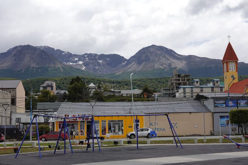
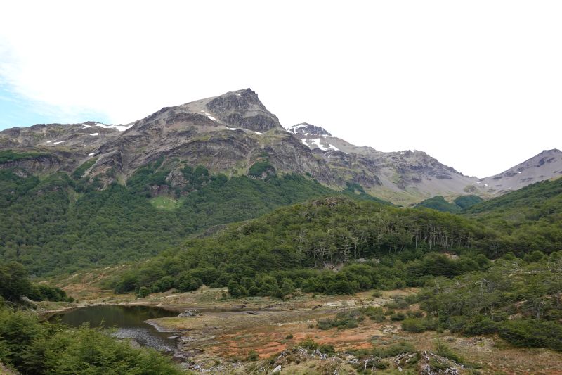
After leaving the city we were truly in the Martial Mountains, which are steep and jagged and rocky.  The tree line seemed outrageously low for us Coloradans, but the conditions here are harsh.  The trees are scraggly and covered in lichen.  The rocks are covered in thick moss.  Honestly, it feels like a cold Lopez Island! 

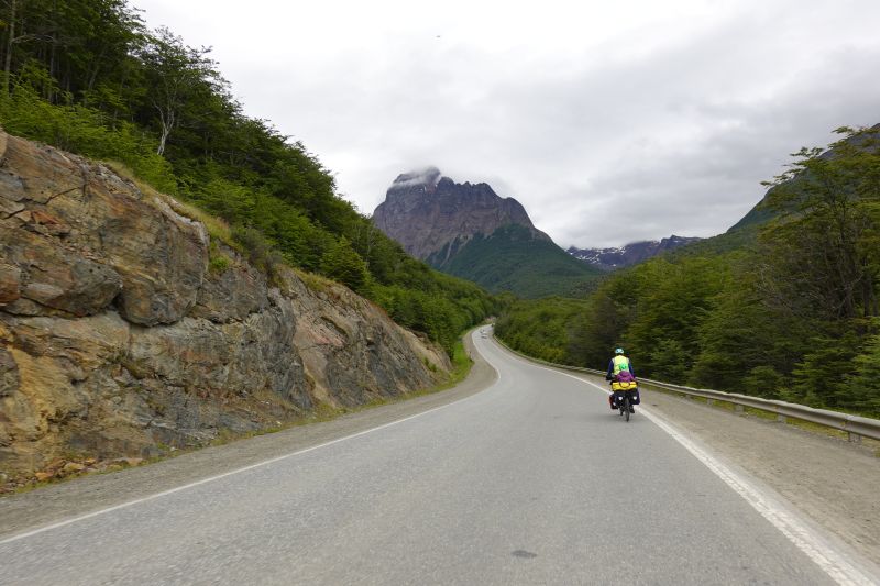
We climbed for the next five miles or so until we were in a huge glacial valley with peaks on either side.  When we saw a fancy lodge on the side of the road… we decided to stop and drink hot chocolates and eat French fries!  They had a raging fire inside and were serving extremely fancy lamb meals to tourists and locals alike.  We were a bit shocked to see the menu price – over $40/person (US dollars)!  Our hot chocolates were much more affordable.

Putting the Click-Stands to good use

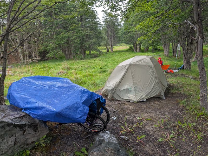
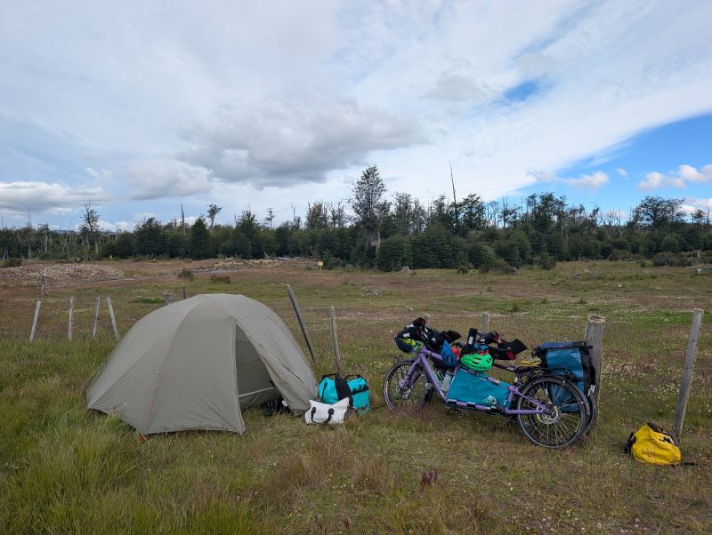
We stopped for the day around 3pm, since there was a lovely campsite next to a small river.  Also, it was threatening rain. It rained for several hours starting at 5pm and continuing into the night.  We cooked up a dinner of pasta with red sauce and scrambled eggs, played hearts (A is winning), and fell asleep cozy in the tent. 

Wild campsite near Cerro Castor

Day 2: Camping near Cerro Castor to Camping at Rio Tuerto (49 km)

This day was magic.  We awoke to sun on the tent and a forest practically glowing with morning light and leftover rain.  For breakfast we had watery oatmeal that no one liked, and then we were riding. 

Creating a Fairy Fortress

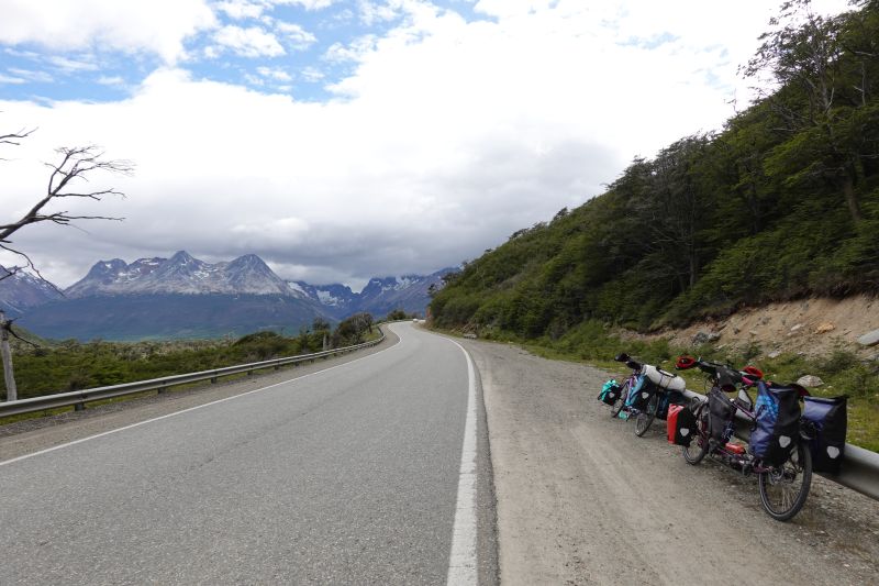
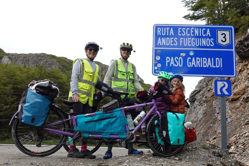
We climbed up and up to the famous pass of this island: Paso Garibaldi.  We had gorgeous mountain views behind us and then a view of the lakes to come ahead of us.  You know we can never resist a good pass sign.

Paso Garibaldi

On the other side it was fast zip down to a small settlement at the end of Lago Escondido (Hidden Lake).  We decided to splurge on a big lunch at a restaurant called La Casona 2, which had a big yard for playing and a big fire they used to roast lambs.  Lunch took a very long time to prepare (over an hour!) but we were happy to be warm.  We laughed because the kids’ hamburger meal was once again just a huge burger patty with a pile of fries.  H promptly grabbed a few pieces of the table bread and made it an American-style hamburger sandwich. A cut hers up and dipped the pieces in ketchup (of course). We were stuffed by the time we were done, but we had 23 kilometers left to ride. 

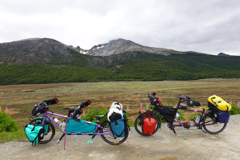
Luckily it was downhill with a tailwind!  We zoomed along until we were near a spot another cyclist had marked as ‘trees with space for tents.’  It was near the river Tuerto, which actually was a much more appealing spot.  We set up camp off the road behind a pile of gravel, next to a picturesque valley. 

Wild camp near Rio Tuerto

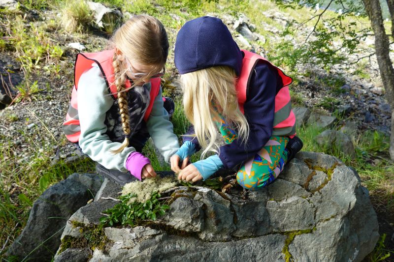
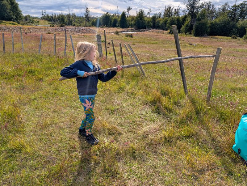
H found a giant stick and was delighted for a long time waving it around; miraculously no one was injured.  Both girls spent a stretch of time collecting flowers and grasses to ‘clean’ our shoes.  It was a delightful evening and it didn’t even rain!

Day 3: Rio Tuerto to Tolhuin (27 km)

We thought today would be easy, but we woke up and had noodle legs.  Maybe it was just me though, since I had run out of coffee!  GASP!

Lago Fagñano

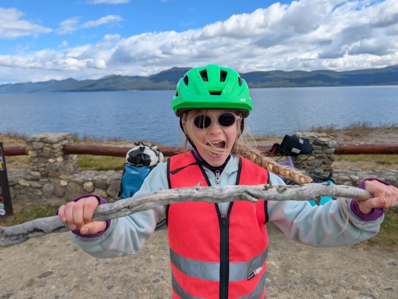
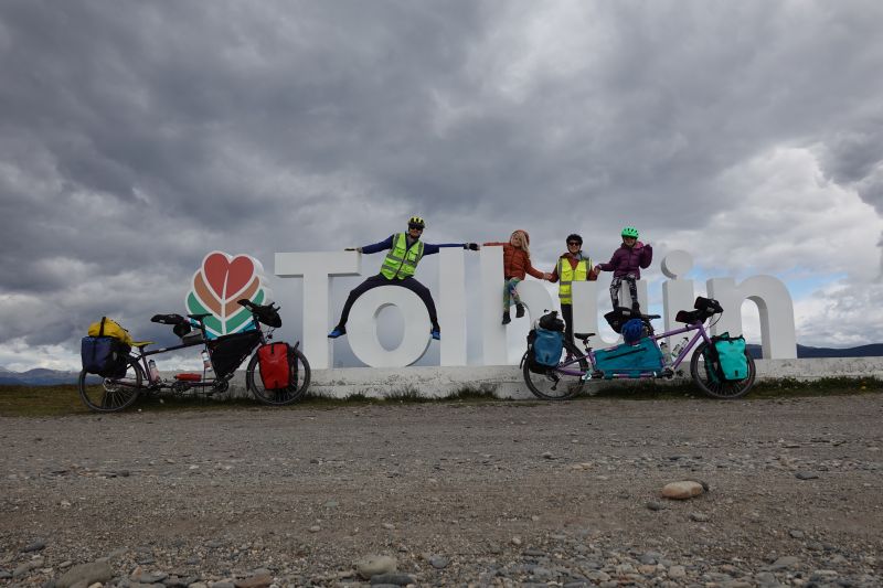
The riding was mostly up and down along the massive Lago Fagnano.  Each little stream that joined the lake required a descent and then a climb.  As we approached town we detoured down to the lake’s edge to see a small wildlife preserve (ducks and other birds) and take a picture with the Tolhuin sign.  Many of the towns here have these big signs and it’s so fun to take pictures with them. 

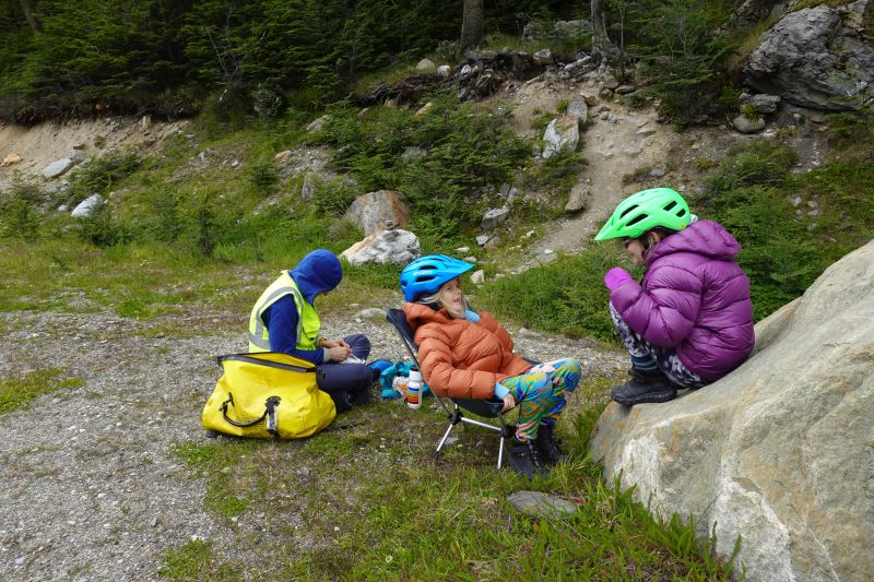
After the sign the road was dirt/gravel and straight up.  In a fit I demanded we stop and eat a snack.  After nearly emptying the remainder of our snack bag (potato chips, marshmallows, cookies, and gummy bears) we continued on. 

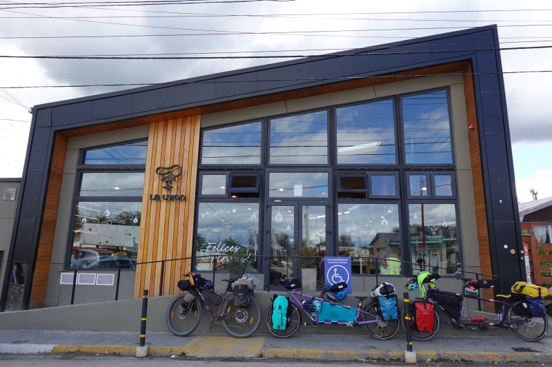
Our destination was a very famous bakery, La Union.  It welcomes touring cyclists from all over the world as they pass through, offering them bunks to sleep on in the basement past towers of flour.  We are not staying there, since it’s better for our family to find private accommodations.  However, we did stop for nearly two hours to eat!  We had empanadas, huge sandwiches, donuts, chocolate, and finally coffee.  It was incredible and we will be back tomorrow. 

La Union bakery

For tonight we are resting out of the wind and rain that is blowing through this town.  We rented a little one room cabin that is warm, cozy, and just a short walk from a grocery store.  Honestly, it feels heavenly.  Our next stretch to Rio Grande is less scenic and more windy, so we need tomorrow to strategize.

These two furry friends were interested in everyone but refused to eat my chicken, and then peed on Jason’s rear wheel

Ushuaia: the end of the world

The city of Ushuaia is the southernmost city in the world. It has captured the imaginations of explorers for decades, and we are no exceptions. I (Daisy) have been dreaming of this place for many years. To actually be here, preparing to embark on our next big cycling adventure, is a dream come true.

Total travel time to get here from our door was about 26 hours. Miraculously, every bag and every bike box arrived undamaged. We spent our first day wandering the town and putting the bicycles together. Ushuaia is cold, windy, wet and full of art.

The city is perched on the edge of the Beagle Channel, surrounded by mountains. It was so dreary we didn’t see them until the fourth day, but they are stunning!

We discovered that both girls love empanadas and most particularly they love “submarinos,” which is the local approach to hot chocolate. To make one you start with steaming hot milk, then melt in a big chunk of dark chocolate before drinking it all down!

I learned the hard way that to buy groceries with a credit card you must show your passport here. Alice and I headed to the store with just a credit card and a few US dollars. At check out I was shocked when they asked for my passport! I tried to pay with the dollars, but they were all too ragged to be accepted. After a long back and forth, I learned that a *photo* of my passport would be good enough and luckily I had one! It was quite a scene.

Here are a few more photos of our time here. Tomorrow we start our journey on bicycles!

The St. Christopher shipwreck. Apparently this ship was assisting another in 1957 and ended up stuck ever since.
The wind is famous here and the huge flags were almost always flapping
This ‘end of the world’ sign is an iconic destination for cyclists
…and of course we found the playgrounds. This one had some particularly cool swings.

Crossing the hiker- biker border into Chile.

No complains when the scenery is like this!

No complaints when the scenery is like this!

The sign that led us to the hiking trail.

The sign that led us to the hiking trail.

This day was so incredible, that we’re dedicating an entire blog post to it.  You see, there is a little-known border crossing between Argentina and Chile that only hikers and cyclists can cross.  It is a 22 km stretch that links two lakes and two countries.  It is stunning and exhausting and epic.  Although we were warned by a great many southbound cyclists of the ‘struggle-fest’ that awaited us, we actually loved this short section that required so much effort.  We didn’t have a strict timeline, so we took our time and had fun.

Jason's ingenious bike set-up.

Jason’s ingenious bike set-up.

The crossing is a mere 22 km (13 miles), but the first 6 km are on a narrow, steep hiking trail and the rest are on a rough dirt track.  Those first 6km took us a total of 5 hours!  At first, the campground kitty kept pace with us as we pushed and tugged our bikes up the trail. It was super steep, but quite good as far as footing goes. I often had to remove my front panniers and rack pack and take everything up in two trips to manage the weight.  In each of the three pictures below, try to find the kitty!

Jan25_004

Jan25_006

Jan25_007

Jason got his own bike across at this stream.

Jason got his own bike across at this stream.

Sometimes the trail was like a bobsled chute, and our front panniers literally couldn’t fit through while on the bikes. Jason was smart and put his front panniers hanging on his top tube, so he almost never had to take two trips. At every stream crossing I took both bikes across so that Jason could keep his feet dry.  Ah, the things we do for love…

Stream crossing with Jason's bike.

Stream crossing with Jason’s bike.

Pushing through the forest.

Pushing through the forest.

We stopped for lunch about 3 km in, setting up in a shaded forest. We had several stream crossings, but sometime after lunch we had the worst stream crossing of all: the bog. The mud was super deep! It tried to suck my sandals off my feet and at times reached halfway to my knee. At one point I got stuck and the bike almost fell in. Luckily, Jason was there and he saved both of us. About an hour after lunch Jason got stuck on a particularly hard section and let his bike fall down. He just left it on the ground, in the path, and declared that it was break time.

This bog was awful!

This bog was awful!

Obligatory border photo.  Pretty quaint border marker though.

Obligatory border photo. Pretty quaint border marker though.

After 5 hours we made it to the border at the top of the pass. Woohoo! We took the celebratory photos and ate the last of a peanut dessert we had bought a few days back. Immediately the rough trail became a rough, but very rideable, track. It felt so good to ride again! There were a few steep uphills, but we mostly got to coast downhill. We passed a (very) primitive landing strip, cows, and horses.

Sometimes the road was very steep downhill, and loose too, so we had to ride with one foot bouncing along on the dirt. Sometimes we had to walk. Soon enough we turned a corner to see the lovely Lake O’Higgins stretching out below us.

The dirt track stretch out before us after the border.

The dirt track stretch out before us after the border.

Some pretty rough bridges on the Chilean side.

Some pretty rough bridges on the Chilean side.

Lago O'Higgins and the road snaking downward.

Lago O’Higgins and the road snaking downward.

Uh oh.  Daisy fall down.

Uh oh. Daisy fall down.

At about 4 o’clock we reached the border control shack, and got through with no problems. We even got to keep our veggies! I think the agent just forgot to ask us about them.

Yippee!  We're getting on the boat!

Yippee! We’re getting on the boat!

By 4:15 we were at the ferry dock, and we decided to catch the boat. While we waited we cooked up a pot of rice, veggies, and tuna to eat on the boat. When the craft actually arrived we were nervous that there wouldn’t be room or that they wouldn’t take our tickets that were technically for tomorrow. No worries though, they just decided that it was ok to have more people than the technical capacity, and they told us we had to sit in the kitchen.

We did spend a bit of time on deck enjoying the scenery before retreating to the warm and comfortable kitchen for a nap all the way to the other side of the lake.

A very nice day for a boat ride.

A very nice day for a boat ride.

Once offloaded, we dealt with the expected chaos of nine cyclists sorting out their bikes and gear after a ferry ride. We took the obligatory photos at the ‘End of the Carretera Austral’ sign, and rode towards town. Although we had originally planned to camp in town, we stopped halfway there to camp for free next to some abandoned boats. It was nice and quiet there, although we were actually ravenous again.

A new chapter begins on the fabled Carretera Austral.

A new chapter begins on the fabled Carretera Austral.

We ate oatmeal for second dinner, and finally went to bed. It started to rain as we ate, and continued through the night. The next morning we made the short ride into town.  You’ll have to wait for the next update to hear more about this fantastic dirt road we’re spending the next three weeks on!

Peaceful camp with some old boats.

Peaceful camp with some old boats.

Glaciers, plains, and finally entering the mountains.

The Perito Moreno Glacier.

The Perito Moreno Glacier.

Another impressive view of the glacier.

Another impressive view of the glacier.

When last we updated, we had just completed our first week of riding in Patagonia. There had been wonderful mountain scenery, open vistas, and strong winds. We stopped for a day in the small town of Calafate, which is mostly new construction and infested with crowds of tourists. Because of this almost overwhelming tide of trendy tourists in outdoor gear, we didn’t spend much time in town. We did, however, go to the area’s main attraction: the Perito Moreno glacier. It was well worth it!

This glacier is one of only two in all of South America that is actually advancing. Every day it advances up to 2 meters, and chunks of ice are constantly breaking off its face to crash into the lake below. We took a 90 minute bus ride to the viewing area, which was actually 5 km of metal boardwalks that criss-cross the hill overlooking the glacier. It was incredibly well-done, and despite the large volume of tourists we never felt like it was a zoo, and we always had a great view.

The blue of a glacial lake never ceases to impress.

The blue of a glacial lake never ceases to impress.

We even got to play with this piece of iceberg that some kids had retrieved from the lake.

We even got to play with this piece of iceberg that some kids had retrieved from the lake.

It was fun to just relax in the sun and watch chunks of ice calve off the glacier. The glacier is as tall as a 24 story building. For you folks back in Bellingham – that’s 9 stories higher than the tallest building in Bellingham! The sound of the ice chunks falling all the way to the water below was a deep rumble that we could feel even from our relatively far off vantage point. We couldn’t get close because it is dangerous. Before they restricted access, 32 people had died at this glacier after being struck by ice spears. Scary stuff indeed.

Our first glimpse of the ice sheet as we approached the national park.

Our first glimpse of the ice sheet as we approached the national park.

Exterior of the famous 'Pink House'

Exterior of the famous ‘Pink House’

After we left Calafate we headed back out into the Argentine plains for another couple days. The wind was yet again a major factor, but we were lucky to shelter in an abandoned house for a night. This house is somewhat of a legend among touring cyclists, and over time it has been cleaned up a bit with many cyclists having left their mark.


Interior of the house.  We shared with Benjamin, a very friendly Austrian cyclist .

Interior of the house. We shared with Benjamin, a very friendly Austrian cyclist.

Our last day of riding through the flat, windy expanse was a bit of a tease. We could see the iconic peaks of the Patagonian Andes slowly growing closer over the course of five hours of riding. The wind got stronger and stronger, until we were crawling along at 6 miles an hour. Eventually, however, we reached the base of those incredible peaks and entered the small town of Chalten.

The 'beware of wind' sign really describes this area well.

The ‘beware of wind’ sign really describes this area well. 

Far off mountains in the morning.

Far off mountains in the morning.

After lunch, getting closer!

After lunch, getting closer!

Almost there!

Almost there!

Holy mountains!

Holy mountains!

Casa de ciclistas - jam-packed.

Casa de ciclistas – jam-packed.

Outside of the Casa de Ciclistas.

Outside of the Casa de Ciclistas.

This town was like a theme park for hikers and backpackers. It is known as the ‘National Trekking Capital’, since for some reason here folks always ‘trek’ and never ‘hike’. Perhaps hiking sounds too mundane. In any case, the town was incredibly scenic and we enjoyed a free night of camping at our first ‘Casa de Ciclistas’. It was a private home run by a local woman who loved to host touring cyclists. Her backyard was jam-packed with tents.

When we finally left Chalten it was to ride 22 miles on a gravel road to a secluded lake where we would catch a pair of ferries separated by a hiking trail where we would need to push the bikes. More on that in the next post. For now, here are some photos from that phenomenal gravel road and the first boat ride.

Heading into the mountains!

Heading into the mountains!

Jan24_008

Maybe we'll use this photo for a calendar in the future.

Maybe we’ll use this photo for a calendar in the future.

A view of the lake from the south side.

A view of the water from the south side of Lago Desierto.

These four British guys were pretty excited to get their bikes on the ferry.

These four British guys were pretty excited to get their bikes on the ferry.


Argentine customs, with Patagonia geese.

Argentine customs, with Patagonia geese.

We camped on the far side next to Argentine customs, and I’m not sure I’ve ever slept in so scenic a location.

The view from our campsite.  No kidding!

The view from our campsite. No kidding!